
How Ground-Penetrating Radar Services Enhance Utility Detection


Understanding Ground-Penetrating Radar (GPR)
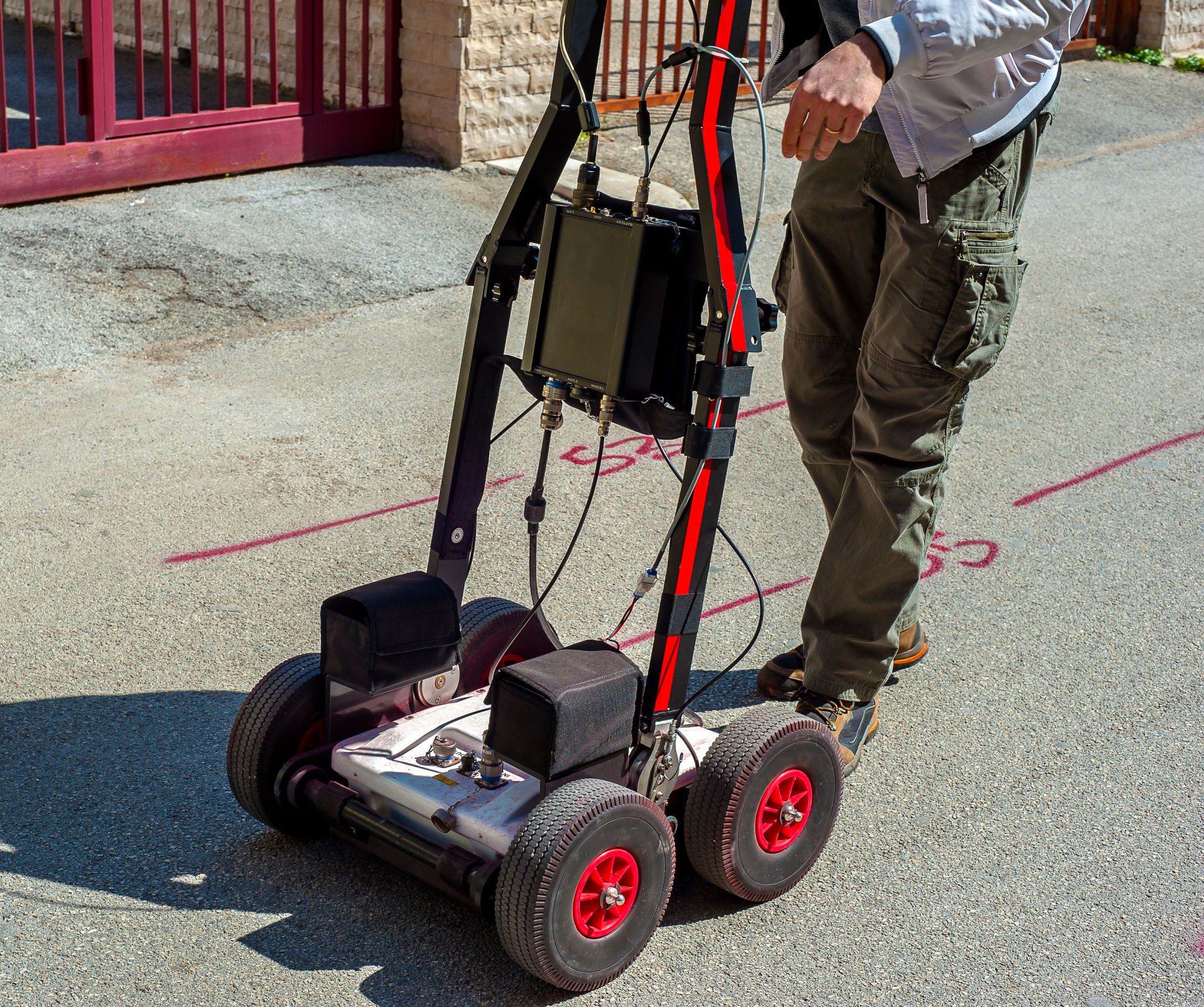
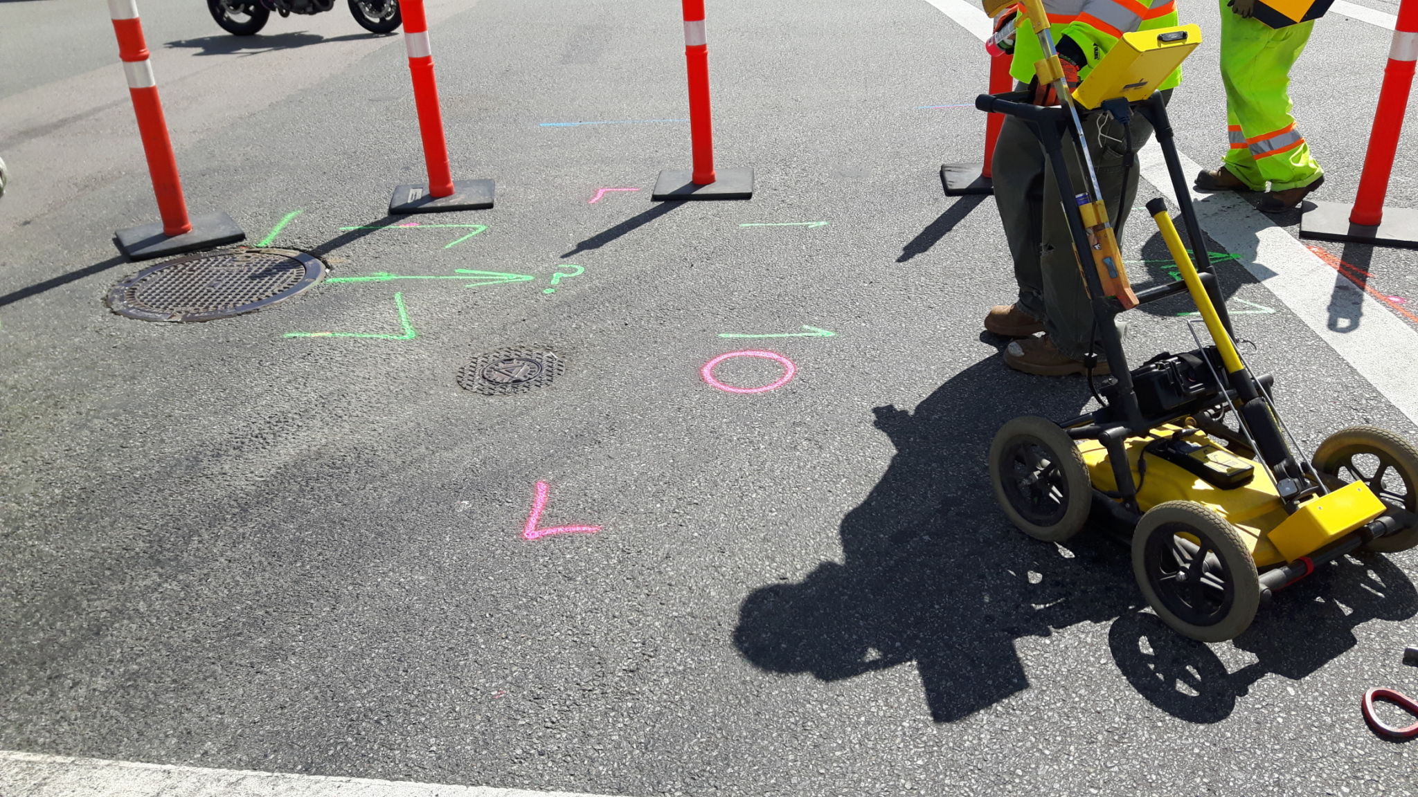
Ground-Penetrating Radar (GPR) is a geophysical method that uses radar pulses to image the subsurface. This non-destructive technique is widely used in utility detection to locate and map underground utilities without digging or drilling. Its efficacy in identifying different types of materials and structures beneath the ground makes it an indispensable tool for engineers and construction professionals.
GPR works by sending a signal into the ground and recording the echoes that bounce back from subsurface structures. These signals help in creating detailed images of what lies beneath, offering precise information about the depth and location of utilities such as pipes, cables, and conduits.
Benefits of Using GPR in Utility Detection
One of the most significant advantages of using GPR services for utility detection is its ability to provide accurate and detailed information without disturbing the ground surface. Unlike traditional excavation methods, GPR is minimally invasive and reduces the risk of damaging existing utilities.
Another benefit is its versatility. GPR can be used in various environments, from urban settings to rural landscapes, and on different surfaces such as concrete, soil, and asphalt. This adaptability ensures that utility detection can be conducted efficiently in almost any location.
Improving Safety and Reducing Costs
By accurately mapping underground utilities, GPR helps prevent accidental strikes during construction projects, which can lead to costly repairs and dangerous situations. Safe excavation practices are crucial, and having a comprehensive understanding of what lies beneath the surface ensures that projects are completed without incident.

Applications of GPR in Different Industries
The use of GPR extends beyond just utility detection. In the construction industry, it is utilized for assessing concrete structures, inspecting bridges, and evaluating the condition of roads. Archaeologists employ GPR to locate artifacts and historical sites without disturbing the soil.
Environmental studies also benefit from GPR as it aids in detecting contamination plumes and monitoring groundwater levels. The technology's ability to deliver high-resolution data makes it invaluable for environmental assessments and remediation efforts.
The Process of Conducting a GPR Survey
A typical GPR survey involves several steps. First, a trained technician conducts a site assessment to determine the best approach for scanning. The GPR equipment is then calibrated, and data collection begins by moving the radar unit over the target area. The collected data is analyzed to create a detailed map of subsurface features.
Choosing the Right GPR Service Provider
When selecting a GPR service provider, it's essential to consider their experience and expertise in utility detection. Look for companies that employ certified technicians and use state-of-the-art equipment to ensure accurate results.
Additionally, reviews and testimonials from previous clients can provide insight into the quality of service you can expect. A reliable provider will not only deliver precise data but also offer comprehensive reports and visualizations that aid in decision-making processes.
Future Trends in Ground-Penetrating Radar Technology
The future of GPR technology looks promising as advancements continue to enhance its capabilities. Emerging technologies such as artificial intelligence and machine learning are being integrated into GPR systems to improve data analysis and interpretation. These innovations promise to make utility detection even more efficient and reliable.
As industries increasingly recognize the value of non-invasive subsurface exploration, the demand for advanced GPR services is expected to grow. Staying informed about these developments will ensure you remain at the forefront of utility detection solutions.