
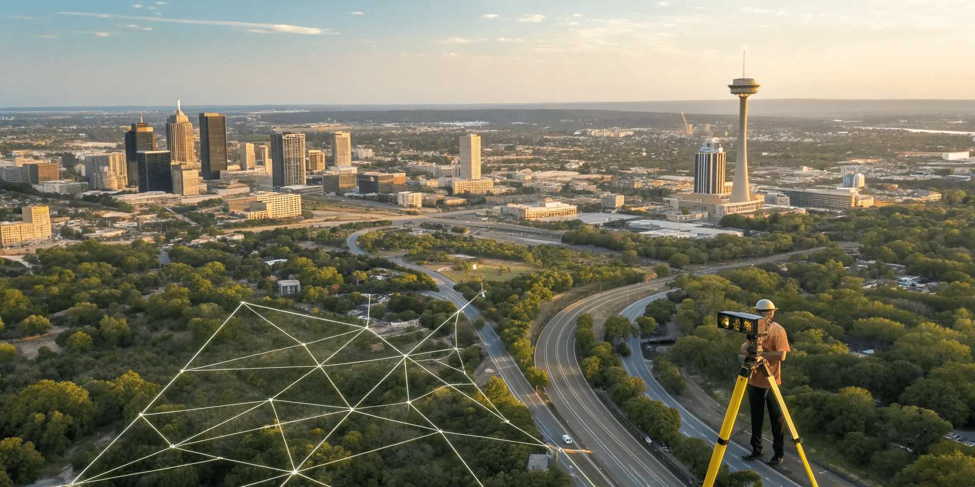
LiDAR Mapping San Antonio: A Project Manager's Guide
A successful project depends on understanding your entire site, not just what you can see on the surface. While many focus on the visible topography, the hidden network of underground utilities is just as critical. LiDAR technology is the gold standard for capturing a precise, data-rich model of the surface, providing the perfect foundation for your site plans. At SiteTwin, we see this as the first step. We integrate this detailed surface data with our expert subsurface mapping services to give you a complete, unified picture. This combination of above-ground and below-ground intelligence is essential for any project. Using LiDAR mapping San Antonio gives you the clarity you need to plan with confidence.
Key Takeaways
- Base Your Plans on Reality, Not Estimates: LiDAR technology delivers a highly accurate 3D site model in hours instead of days, giving you a reliable foundation for design and engineering without the delays of traditional surveying.
- Map Challenging Sites with Confidence: LiDAR works through obstacles like dense vegetation and poor lighting, capturing the true ground surface to give you a clear and complete site model, no matter the conditions.
- Put Your Data to Work Immediately: Final LiDAR files are delivered in standard formats compatible with your existing CAD and GIS software, so your team can start designing and planning right away without learning new programs.
What Is LiDAR Mapping & How Does It Work?
If you’ve ever felt like you were making decisions with an incomplete picture of your job site, you’re not alone. LiDAR mapping is a technology that gives you a clear, data-rich view of your project area, helping you plan better and avoid surprises. LiDAR stands for Light Detection and Ranging, and it’s essentially a way to measure distances using light.
Think of it as a high-tech tape measure that can take millions of measurements in just a few minutes. This process generates a highly detailed 3D model of the site, capturing everything from ground elevation to existing structures. While our team at SiteTwin focuses on mapping what’s underground, understanding the surface topography with LiDAR is a critical first step for many projects. A complete site assessment requires knowing what’s both above and below ground, and LiDAR provides the above-ground piece of that puzzle with incredible detail.
How the Technology Works
At its core, LiDAR’s function is to create high-resolution 3D maps by measuring distances with laser pulses. A LiDAR system, often mounted on a drone or vehicle, sends out thousands of laser beams per second. These beams hit objects on the ground—like buildings, trees, and the earth itself—and bounce back to the sensor. The system measures the exact time it takes for each pulse to return.
By combining this timing data with information from a specialized GPS, the system calculates precise 3D coordinates for every point the laser hits. The result is a massive collection of points called a "point cloud," which forms an incredibly accurate 3D model of your site. This serves as the foundation for detailed site plans, elevation maps, and analysis.
Common Uses in Construction & Commercial Projects
While LiDAR has applications in everything from archaeology to autonomous driving, it’s a game-changer for construction and commercial development. For project managers and GCs, LiDAR provides the data needed for smarter planning and execution. You can use it for topographic surveys to understand site contours before breaking ground, or for as-built surveys to verify that construction matches the original design.
It’s also perfect for calculating soil volumes for cut-and-fill operations, monitoring infrastructure for any changes over time, and even planning utility routes. By capturing a complete and accurate snapshot of your site conditions, you can improve project logistics, reduce rework, and keep your project on schedule from day one.
LiDAR vs. Traditional Surveying
Compared to older methods, drone LiDAR mapping is significantly faster and often more accurate. A traditional survey crew could spend days or weeks walking a large site, taking manual measurements. A LiDAR-equipped drone can capture more comprehensive data in a matter of hours. This speed means you get actionable information faster, allowing you to move forward with planning and design without delay.
LiDAR also has an edge over other remote sensing methods like photogrammetry, which uses photos to create 3D models. Because LiDAR uses its own light source, it isn’t affected by shadows or poor lighting. It can also penetrate vegetation to map the actual ground beneath tree cover, providing a truer topographic model. This makes LiDAR a more reliable and efficient solution for getting precise data in all kinds of conditions.
Why Use LiDAR Mapping in San Antonio?
When you're managing a project in a rapidly growing area like San Antonio, you can't afford guesswork. Timelines are tight, budgets are scrutinized, and the ground itself can be full of surprises. This is where LiDAR mapping moves from a "nice-to-have" to a necessity. It delivers a clear, data-rich picture of your site so you can plan with confidence and avoid costly mistakes down the line. Here’s how it gives your project a competitive edge.
Gain Unmatched Accuracy and Precision
At its heart, LiDAR is about precision. The technology uses lasers to create incredibly detailed maps and 3D models of your site. Think of it as millions of measurement points creating a digital twin of your property. For a project manager, this level of detail is invaluable. It means your site plans are based on reality, not estimates. You can design with confidence, knowing exactly where existing structures are, how the topography slopes, and how your new construction will fit. This high-resolution data minimizes the risk of clashes, rework, and change orders that can derail a project schedule and inflate your budget.
Save Time and Reduce Project Costs
Traditional surveying methods are thorough, but they can be slow, especially on large or complex sites. LiDAR changes the equation entirely. A drone equipped with LiDAR can map large areas quickly, often covering hundreds of acres in a single day. For projects that used to take weeks of fieldwork, the same data can now be captured in a matter of hours. This speed directly translates to savings. You reduce field crew hours, shorten the pre-construction phase, and get your project moving faster. This aligns perfectly with the need for fast, field-ready data that keeps your project on schedule and prevents costly delays from compounding.
Handle Tough Texas Terrain and Weather
The landscape around San Antonio isn't always a flat, open field. From dense Hill Country vegetation to uneven ground, the terrain can make traditional surveying a real challenge. LiDAR excels in these conditions. Its laser pulses can penetrate vegetation, capturing detailed ground data even in heavily wooded areas. This gives you a true "bare earth" model to work from—something that’s nearly impossible with other methods. It also performs well in various lighting conditions, giving you a wider window for data collection. Instead of fighting the terrain, you get a clear picture of it, allowing for smarter, safer site planning from the start.
Get Actionable Data, Faster
The real power of LiDAR isn't just in the data it collects, but in how quickly you can use it. The output—typically a point cloud—can be integrated directly into your existing CAD and GIS software. This means your engineering and design teams aren't waiting weeks for survey data to be processed and drafted. They get a rich, 3D dataset they can work with almost immediately. This rapid turnaround from field to office allows you to make informed decisions faster, spot potential issues earlier, and keep your project on track. It’s about turning raw site information into actionable intelligence without the usual delays.
Finding the Right LiDAR Company in San Antonio
Choosing the right partner for LiDAR mapping is about more than just technology; it's about finding a team that understands your project's specific challenges. You need a provider who can deliver clean, actionable data that integrates seamlessly into your workflow, preventing delays and costly surprises. The right company will act as an extension of your team, helping you see the unseen and plan with confidence. From initial site walks to final data delivery, clear communication and expertise are non-negotiable.
SiteTwin: Your Partner in Subsurface & Utility Mapping
While many companies offer aerial LiDAR, your project often demands a closer look at what’s happening on—and under—the ground. At SiteTwin, we specialize in combining advanced mapping technologies to give you a complete picture. We integrate high-precision ground-based scanning with our core subsurface utility mapping services to create a comprehensive model of your site. This means you get more than just a surface map; you get a detailed view of utilities, foundations, and other critical subsurface features. Our expert crews deliver field-ready data without the runaround, helping you plan soil borings, trenching, and site upgrades with total clarity. We’re your direct line to the data you need to keep your San Antonio project safe and on schedule.
Comparing Local LiDAR Providers
When you start looking for a LiDAR provider in the San Antonio area, you'll find that services and pricing can vary quite a bit. Costs are often influenced by the project size, the complexity of the terrain, and the required level of detail. Some companies specialize in large-scale aerial surveys, while others, like us, focus on detailed ground-level scans for design and construction. Instead of just comparing price per acre, consider what you get for your investment. Look for a provider who understands the specific demands of construction projects, where precision is critical to avoiding rework and budget overruns. A cheaper scan that isn't accurate or doesn't capture the right data will end up costing you more in the long run.
Key Questions to Ask Before Hiring a Provider
To find the best fit for your project, you need to ask the right questions. A reputable provider will be happy to walk you through their process and qualifications.
Start with these essentials:
What is your experience with projects like mine in the San Antonio area?
What type of LiDAR equipment and software do you use?
What are your quality control procedures for both data capture and processing?
What are the final deliverables (e.g., point cloud, 2D CAD, 3D model), and are they compatible with my team’s software?
How do you handle challenges like heavy vegetation, active job sites, or bad weather?
Their answers will give you a clear idea of their capabilities and whether they can meet your project’s specific needs.
How LiDAR Solves Common Project Hurdles
One of LiDAR’s biggest strengths is its ability to overcome common site survey challenges that can derail a project schedule. The technology excels at capturing incredible detail, even in difficult conditions. For example, LiDAR can penetrate vegetation to map the true ground surface beneath tree canopies or dense brush—a huge advantage for projects on undeveloped land. It also works effectively in low-light conditions, offering more flexibility for scheduling scans. This ability to gather detailed data regardless of foliage or time of day means you get a more complete and accurate dataset from the start. You can identify potential issues like drainage problems or unexpected terrain variations before they become expensive problems during construction.
How Much Does LiDAR Mapping Cost?
Let's get straight to the point: you need to know the budget. While there’s no simple price tag for LiDAR mapping, the cost is far more predictable than the expense of an unexpected utility strike or a major design revision. Think of it as an investment in certainty. The final price depends entirely on your project’s specific needs, but it’s almost always a fraction of the cost of the problems it prevents.
The price of a LiDAR scan is shaped by a few key variables, from the size of your San Antonio job site to the level of detail you need. A quick aerial survey of a flat, 10-acre lot for preliminary planning will cost less than a high-resolution scan of a complex industrial facility with dense infrastructure. The key is that you’re paying for exactly the data you need—no more, no less. We can break down the factors that influence your quote so you can see exactly where your money is going and why it’s a smart move for your project’s timeline and budget.
What Factors Influence the Price?
The cost of LiDAR mapping isn't arbitrary; it's tied directly to the work involved. The biggest factors are project size and complexity. A large, open field is straightforward, but a site with dense trees or multiple buildings requires more intricate flight planning and data processing. The required data resolution also plays a major role. If you need survey-grade accuracy for detailed engineering design, the scanner will need to capture more data points, which takes more time. Finally, your requested deliverables—whether you need a raw point cloud, a 3D model, or CAD-ready files—will influence the amount of office time needed to process the data into a clean, actionable format.
How to Get an Accurate Quote for Your Project
To get a firm, reliable quote for your project, the best approach is to provide as much detail as possible upfront. A good mapping partner will want to understand your goals completely. Before you call, try to have your project boundaries ready (a KMZ or shapefile is perfect), a clear idea of the features you need to capture, and the final format you need the data in. This information allows us to scope the work accurately and give you a price you can count on. The goal is to provide a clear path from your request to a final deliverable, so don't hesitate to discuss your project's needs with an expert.
The LiDAR Process: What to Expect from Start to Finish
The LiDAR process is efficient and minimally disruptive to your site operations. It starts with a planning phase where we define the project scope and plan the flight path. Next, our crew comes to your site to perform the scan, which is often completed in just a few hours. The real magic happens back in the office, where we process the millions of data points, classifying and cleaning them to create a precise digital twin of your site. This meticulous work is what turns raw data into a powerful tool, preventing the small discrepancies that can lead to costly construction delays and rework down the line.
Integrating LiDAR Data into Your Existing Workflow
We know that new technology can seem intimidating, but LiDAR data is designed to fit right into your team’s existing workflow. The final deliverables are provided in standard industry formats that are compatible with software you already use, like AutoCAD, Civil 3D, and GIS platforms. While processing raw LiDAR data can be complex, we handle all the heavy lifting. You don’t need to become a data scientist; you just get clean, engineer-ready files that your team can use immediately for planning, design, or as-built verification. The goal is to give you actionable intelligence, not a technical headache.
Frequently Asked Questions
What’s the real difference between LiDAR and the drone photos I can get for my site? Think of it this way: drone photos create a 3D model by stitching together images, which is useful but can be distorted by shadows or miss details under tree cover. LiDAR, on the other hand, uses lasers to take millions of direct measurements of the ground and any structures. This process creates a more precise and reliable 3D model because it isn't dependent on lighting and can capture the true ground elevation even through vegetation.
My project site has a lot of trees and brush. Can LiDAR still map the ground accurately? Yes, and this is one of the main reasons LiDAR is so effective for Texas terrain. The laser pulses are sent out in rapid succession, and many of them will find their way through gaps in the leaves and branches to hit the ground. Our processing software can then filter out the points that hit vegetation, leaving you with a clean and accurate "bare earth" model of your site's true topography.
How long does it take to get the final data after the scan is done? The on-site scan itself is very fast, often taking just a few hours. The majority of the work happens back in the office, where our team processes the raw data to ensure its accuracy and create your final deliverables. The exact timeline depends on the size and complexity of your project, but we prioritize a quick turnaround because we know that project schedules are tight. We will always provide a clear delivery schedule with your quote.
Do I need to buy special software to view or use the LiDAR data? Not at all. We deliver the final data in standard industry formats that are designed to work seamlessly with the software your team already uses, like AutoCAD, Civil 3D, or other GIS platforms. Our goal is to provide you with clean, engineer-ready files that you can put to work immediately without any technical headaches or extra software costs.
I thought SiteTwin focused on underground utilities. How does LiDAR fit into your services? That's a great question. While our core expertise is mapping what's underground, a successful project requires a complete picture of the entire site. We use LiDAR to create a highly accurate surface model that serves as the foundation for our subsurface mapping. By integrating the above-ground data with our underground utility locates, we provide a single, comprehensive model that shows you exactly what you're dealing with, both on the surface and below it.