
Locate Utilities Before Digging: Your Essential Guide
You already know the first step for any excavation is to call 811. But what happens after the public lines are marked? Relying solely on that free service leaves you with a dangerously incomplete picture of what’s actually on your site. Any power lines running to a detached garage, irrigation systems, or fiber optic cables connecting buildings are considered private and won't be marked. This is the critical gap where most accidents happen. To truly ensure a safe site, you have to locate utilities before digging—all of them. This guide explains how to go beyond 811 for a complete picture.
Key Takeaways
- Go beyond the free 811 call: Public utility locators only mark lines up to the meter, leaving you blind to private infrastructure on your property. A complete and safe site plan requires hiring a private locator to find everything 811 misses, from secondary power lines to irrigation systems.
- Treat the tolerance zone as a no-machine zone: The paint marks on the ground are only an estimate. Within the 18- to 24-inch tolerance zone on either side of a marked line, you must switch to hand digging or vacuum excavation to visually confirm a utility's exact location and depth before proceeding.
- Get a true picture with modern technology: Outdated plans and basic detectors won't find non-metallic lines like PVC pipes or fiber optic cables. Ensure your locator uses advanced tools like Ground Penetrating Radar (GPR) to create an accurate, field-ready map that accounts for every type of buried utility.
Why You Must Locate Utilities Before Digging
Breaking ground on a new project is exciting, but what lies just a few feet beneath the surface can bring everything to a halt. Before any excavator bucket or auger touches the soil, locating underground utilities is the single most important step you can take. It’s not just about following rules; it’s about protecting your people, your budget, and your timeline from completely avoidable disasters. A utility strike can turn a profitable project into a costly, dangerous, and prolonged nightmare. Taking the time to map out the subsurface isn't just a preliminary task—it's the foundation of a safe and successful excavation.
Protect Your Crew and Your Project
Nothing is more important than the safety of your crew. Digging blind is a massive gamble with their well-being. Hitting a buried electrical line can cause severe injury or electrocution, while striking a natural gas line can lead to explosions and fires. Even severing a water main can destabilize trenches and create hazardous site conditions. These aren't theoretical risks; they are real-world dangers that have catastrophic consequences. As a project manager or site owner, you have a responsibility to create a safe work environment. That starts with giving your team a clear and accurate map of every potential hazard buried underground, ensuring they can work confidently and without fear of a life-altering accident.
Avoid Costly Strikes and Downtime
A single utility strike can derail your entire project schedule and budget. The immediate costs include emergency repairs and potential fines from regulatory bodies, which can run into the thousands. But the financial damage doesn't stop there. You’ll face significant project downtime while services are restored, forcing your crew and equipment to sit idle. This delay creates a domino effect, pushing back deadlines and potentially incurring contractual penalties. Beyond the immediate financial hit, a utility strike can damage your company’s reputation. Ensuring you have a complete picture of the subsurface with professional utility locating services is a small investment that prevents crippling expenses and protects your professional standing.
Prevent Environmental Damage
The consequences of a utility strike extend beyond your job site. Hitting a sewer line can release raw sewage into the ground, contaminating soil and local water sources. A damaged fuel or chemical line can cause a hazardous spill, requiring immediate and expensive environmental cleanup efforts. These incidents not only harm the local ecosystem but can also trigger involvement from environmental protection agencies, leading to complex legal issues and long-term liability. By identifying all buried infrastructure beforehand, you act as a responsible steward of the land you’re working on. A thorough subsurface utility mapping plan is a critical part of responsible environmental management and prevents a costly cleanup that no project budget accounts for.
How the Utility Locating Process Works
Understanding what’s buried on your site is a critical step for any excavation project, but the process isn’t always straightforward. It involves more than just one phone call. A safe and successful dig requires a two-part approach: starting with the public 811 service and then bringing in a private locator to fill in the crucial gaps. By building both of these steps into your plan from the beginning, you can get a complete and accurate map of all underground infrastructure, protecting your crew, your budget, and your timeline. This proactive approach is the difference between digging with confidence and digging blind.
What 811 Covers (and What It Doesn't)
Think of 811 as your mandatory first step. This free national service is designed to locate and mark publicly owned utility lines—the ones that run from the main street up to your property’s meter. This includes major gas, water, electric, and communication lines. While essential, the 811 service stops at the meter. Any utilities beyond that point are considered private and will not be marked. This includes power lines running to a detached garage, septic systems, sprinkler lines, or communication cables connecting different buildings on a campus. Relying solely on 811 leaves you with a dangerously incomplete picture of what’s actually underground.
The Role of Private Utility Locators
This is where a private utility locator comes in. After 811 marks the public lines, a private firm like SiteTwin takes over to map everything else on your property. We use advanced methods like Ground Penetrating Radar (GPR) and Electromagnetic (EM) locating to find what 811 misses. Our utility locating services can detect both metallic and non-metallic lines, including tricky targets like PVC or fiber optic cables. Hiring a private locator is the only way to get a comprehensive view of your entire site, ensuring there are no surprises once excavation begins.
How to Plan Your Project Timeline
To keep your project on schedule, it’s best to coordinate your locates in advance. You should call 811 at least a few working days before you plan to dig, as the required notice period varies by state. Once you have your 811 ticket number, schedule your private utility locator. Ideally, the private locator can come to the site right after the public utilities have been marked. This allows them to verify the public marks and focus on identifying all the private lines. Building both of these steps into your pre-construction checklist prevents costly delays and ensures your crew can break ground on time.
Get a Complete Picture That Goes Beyond 811
Relying only on 811 is like having a map with half the roads missing. You can see the major highways, but all the local streets are invisible. A complete picture requires combining the public utility marks from 811 with a thorough private locate. This integrated approach provides the comprehensive data you need to dig safely and avoid catastrophic strikes. By investing in a full subsurface utility mapping, you move from guesswork to certainty, ensuring your project is built on a foundation of accurate, field-ready data.
What's Actually Buried Beneath Your Site?
Before the first shovel hits the dirt, it’s critical to understand what you’re working with. The ground beneath your project site is often a complex network of pipes, cables, and conduits installed over decades. Assuming you know what’s down there based on old plans or surface-level features is a recipe for disaster. A thorough investigation is the only way to get a clear, accurate picture of the subsurface environment and keep your project on track.
Know the Difference: Public vs. Private Lines
The first step in any excavation project is to call 811. This free service notifies public utility companies to come out and mark the lines they own, like city water mains, sewer lines, and natural gas feeds. However, their responsibility stops at the meter. Any utility that runs from the meter to your building or between structures on your property is considered private. This includes everything from electrical lines running to parking lot lights and security cameras to fire mains, irrigation systems, and fiber optic cables. Locating these private lines is your responsibility, and it’s where a professional utility locating service becomes essential.
Identify Common Utilities and Their Depths
A typical commercial site can host a wide range of utilities, including water, gas, electric, sewer, storm drains, and telecommunications. While building codes often suggest standard burial depths, you should never assume those standards were followed or that site conditions haven't changed. Over time, grading and erosion can significantly alter the amount of cover over a line. In fact, some utility lines can be buried as little as two feet deep, making them vulnerable to even minor excavation work. Without a precise location and depth reading, you’re digging blind and risking a dangerous and costly strike.
The Challenge of Finding Non-Metallic and Unknown Lines
Many modern utilities, like PVC water lines, fiber optic conduits, and concrete storm drains, are non-metallic. This makes them invisible to traditional metal detectors. As one expert notes, "PVC pipes are hard to find because they don't have much metal," rendering standard locating tools ineffective. Adding to the complexity are unknown or abandoned lines left over from previous construction. These "ghost" utilities don't appear on any as-built plans but can still cause major headaches, damage equipment, and create safety hazards if struck. Relying on outdated records or incomplete locating methods leaves you exposed to these hidden risks.
How Modern Detection Technology Works
To get a complete picture of the subsurface, you need technology that goes beyond basic detection. This is where methods like Ground Penetrating Radar (GPR) and Electromagnetism (EM) come in. GPR is the most effective tool for finding both metallic and non-metallic pipes, sending radio waves into the ground to create a detailed image of what lies beneath. For conductive utilities like metal pipes and tracer wires, EM locators can trace their paths with incredible precision. By combining these technologies, an expert crew can create a comprehensive subsurface utility map that identifies all buried infrastructure, giving your team the confidence to dig safely.
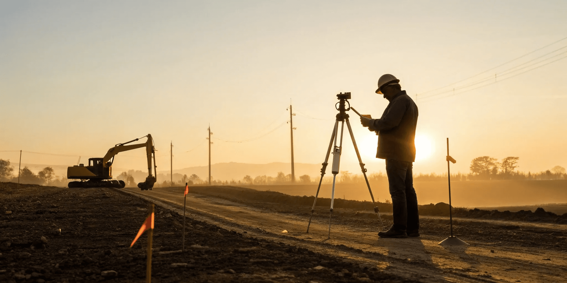
How to Read the Marks on the Ground
Once the utility locators have visited your site, you’ll see a colorful display of paint and flags. These marks are your roadmap to the subsurface, showing you what’s buried and where. But they only keep your crew safe if you know how to interpret them correctly. Misreading the marks or ignoring them altogether can lead to dangerous utility strikes, costly project delays, and serious liability. Think of this as the final, critical step in your due diligence before the first bucket of dirt is moved. Understanding this universal language is non-negotiable for a safe and successful excavation.
A Guide to the Universal Color Code
Utility locating follows a standardized color code to identify what type of line is buried underground. This system, established by the American Public Works Association, ensures that a gas line in Texas is marked the same way as one in California, creating a clear and consistent language for all excavation crews. Before you dig, make sure your entire team is familiar with these colors:
Red: Electric power lines, cables, or conduit
Yellow: Gas, oil, steam, or other gaseous materials
Orange: Communication lines, including fiber optics, cable TV, and alarm systems
Blue: Potable (drinking) water
Purple: Reclaimed water, irrigation, and slurry lines
Green: Sewer and drain lines
White: Proposed excavation area
Pink: Temporary survey markings
Knowing this color-coding system is the first step to understanding the complex network of utilities running through your job site.
What Do the Flags and Paint Really Mean?
The flags and paint on the ground indicate the approximate horizontal position of a utility line. It’s important to remember the word “approximate.” These marks are a guide, not a guarantee of the exact location. They tell you that a utility is running somewhere within a specific corridor. The marks don't provide information on the depth of the utility, which can vary significantly along its path due to grading changes, erosion, or previous site work. For this reason, you must keep the markings clear and visible throughout your project. If they fade or are disturbed, you’ll need to request a re-mark to ensure your crew continues to work safely.
Respect the Tolerance Zone
The "tolerance zone" is a critical safety buffer that extends on either side of the marked utility line. While the exact width can vary by state, it is typically 18 to 24 inches from the outer edge of the marked line. Within this zone, you are required to use extreme caution. That means no mechanized equipment. The only safe way to excavate within the tolerance zone is to carefully hand dig or use vacuum excavation until the utility is physically exposed and visually identified. This process, often called "potholing," confirms the exact horizontal and vertical location of the line, allowing your crew to proceed with confidence and avoid a costly strike.
Handle Crowded Utility Corridors
On a busy commercial site or in a dense urban area, the ground can look like a tangled rainbow of paint and flags. This is a crowded utility corridor, where multiple lines—both public and private—run close together. Trying to dig safely in these conditions can be incredibly challenging, as crossing lines and unclear markings increase the risk of a mis-dig. This is where simple paint marks fall short. For complex sites, you need more than just a line on the ground; you need a comprehensive map of the entire subsurface. A detailed subsurface utility mapping service provides a clear, consolidated view of every pipe and cable, turning confusion into clarity and helping you plan your excavation with precision.
Your Guide to Safe Digging Practices
Once the utilities are marked, the real work begins. But safe excavation is more than just avoiding the paint and flags on the ground. It’s about having a clear, repeatable process that protects your crew, your schedule, and your budget. Following a consistent set of practices ensures every dig starts and ends safely, without any costly surprises. From your initial call to your final report, these steps will help you manage your site with confidence and professionalism.
The Essential Pre-Excavation Checklist
Before any soil is disturbed, your first step is always to contact 811. This is a legal requirement and a free service that notifies public utility operators to mark their lines on your property. You should make the call a few days before you plan to dig, as it gives the utility companies time to respond. Provide the operator with the specific location and scope of your work. Remember, this initial call only covers public utilities. For a complete picture of what’s buried on your site, you’ll also need to schedule a private utility locating service to identify lines that 811 doesn’t cover.
Know When to Hand Dig
The marks on the ground are not an exact science; they indicate the approximate location of a utility. That’s why every state has a "tolerance zone," typically 18 to 24 inches on either side of the marks. Within this zone, you must use extreme caution. Mechanical equipment is off-limits until you have visually confirmed the exact location and depth of the utility line. The best practice is to use soft digging techniques, such as hand tools or vacuum excavation, to carefully expose the line. This simple step is one of the most effective ways to prevent a utility strike and is a non-negotiable part of any safe digging plan.
Select the Right Equipment
Your safety and accuracy depend on using the right tools for the job. While basic electromagnetic (EM) locators can find conductive pipes, they can’t detect non-metallic lines like PVC, concrete, or fiber optics. This is where advanced technology becomes essential. Ground Penetrating Radar (GPR) is the industry standard for identifying both metallic and non-metallic targets, giving you a much clearer picture of the subsurface. By working with a locator who uses a combination of EM and GPR technology, you can confidently identify a wider range of buried infrastructure and avoid making assumptions about what lies beneath your site.
Create an Emergency Response Plan
Even with the best planning, accidents can happen. That’s why a clear emergency response plan is crucial. Your entire crew should know exactly what to do if a utility line is struck. This plan should include immediate contact numbers for utility companies, emergency services, and your project supervisor. It should also outline steps for evacuating the area, especially in the event of a gas line rupture. Having a documented plan and ensuring everyone is trained on it can prevent a minor incident from becoming a major disaster. Remember, you are still liable for damages, so a swift, organized response is key.
Document Everything for a Clear Record
Thorough documentation protects you and your project. Before you begin, record your 811 ticket number and take clear photos of the utility markings from multiple angles. These marks can fade or be disturbed, so having a visual record is invaluable. Once your private locate is complete, keep the detailed report and map on file. This information creates a comprehensive record of due diligence and provides a clear reference for your team throughout the project. This level of subsurface utility mapping not only ensures safety but also serves as a valuable asset for any future work on the site.
Frequently Asked Questions
I called 811. Isn't that enough to start digging? Calling 811 is the essential first step, but it only covers publicly owned utilities—the lines that run from the main street to your property’s meter. Any utility infrastructure past that point is considered private and is your responsibility to locate. This includes things like power lines running to parking lot lights, water lines for irrigation systems, or fiber optic cables connecting different buildings. Relying only on 811 leaves you with a dangerously incomplete map of your site.
Why can't I just rely on my site's as-built drawings or blueprints? While as-built plans are a helpful reference, they should never be your only source of information. These documents are frequently outdated and often fail to show repairs, reroutes, or upgrades made over the years. More importantly, they won't show any abandoned or unknown lines left behind from previous construction. A physical utility locate verifies what is actually in the ground today, protecting you from the costly surprises that old paperwork almost always misses.
How do you find plastic pipes or other non-metallic utilities? Standard locating tools work by detecting the electromagnetic signal from metallic pipes and cables. They are completely ineffective for finding non-conductive materials like PVC, concrete, or fiber optic conduit. To find these targets, we use advanced methods like Ground Penetrating Radar (GPR). This technology sends radio waves into the ground to create a detailed image of the subsurface, allowing us to identify both metallic and non-metallic objects without guesswork.
What exactly is the 'tolerance zone' and why is it so important? The tolerance zone is a safety buffer that extends on both sides of a marked utility line, typically 18 to 24 inches. Within this designated area, you cannot use any mechanized digging equipment. The paint and flags only give you an approximate location, and this zone accounts for that margin of error. The only safe way to excavate within the tolerance zone is to carefully hand dig or use vacuum excavation until you have visually confirmed the utility's exact depth and position.
What should I do if the paint markings on the ground are unclear or get disturbed? If the markings become faded, washed away by rain, or scraped off by equipment, you should stop all excavation work in that area immediately. Digging with unclear marks is the same as digging blind. You need to contact the appropriate locators—both 811 and your private firm—to request a re-mark. This is why documenting the initial marks with photos is a great practice, as it gives you a clear record to reference while you wait for the new marks.