
Subsurface Utility Engineering (SUE) Services Explained
You’ve done your due diligence and called 811, but that’s only half the story. The public utility locating service is designed to mark public mains, often stopping at the property line. It won’t identify the private water lines, electrical conduits, or fiber optic cables running across your site. Relying solely on 811 leaves you exposed to significant risk. To get a complete picture, you need a process that investigates everything beneath the surface. Professional subsurface utility engineering (SUE) services fill this critical gap by using advanced geophysical methods and a systematic approach to map all buried infrastructure, giving your team the comprehensive data needed to design and excavate with confidence.
Key Takeaways
- Use SUE to manage underground risks proactively. Instead of reacting to costly utility strikes and project delays, an upfront investment in SUE provides a clear map of what’s below ground so you can design and build with confidence.
- Match the SUE Quality Level to your project's needs. Apply comprehensive mapping (Quality Level B) for general planning and reserve precise physical verification (Quality Level A) for high-risk areas to get the accuracy you need without overspending.
- Choose a provider with the right tools and expertise. The best results come from teams that combine modern technology, like Ground Penetrating Radar (GPR) for finding non-metallic lines, with the field experience to interpret complex data accurately.
What is Subsurface Utility Engineering (SUE)?
Think of Subsurface Utility Engineering (SUE) as a comprehensive engineering process designed to give you a clear and reliable picture of what’s happening underground. It’s not just about marking lines on the ground; it’s a systematic approach that combines civil engineering, surveying, and advanced geophysical methods to manage the risks associated with buried utilities. While the public 811 service marks known public utility lines, SUE is the next step, providing a much deeper level of detail for private properties and complex project sites where public records are often incomplete or non-existent.
This process was developed to help project owners, engineers, and contractors avoid the costly surprises that come from hitting unknown or poorly mapped utilities. By using a structured workflow, SUE provides verifiable information about the location, depth, and type of underground infrastructure. This data is crucial for planning, design, and construction, ensuring that your project moves forward safely and without unexpected delays. It’s a proactive strategy that turns subsurface unknowns into manageable, well-defined assets, giving your team the confidence to break ground. The Federal Highway Administration has long recognized SUE as a practice that saves time, money, and protects workers by preventing conflicts before they happen.
What SUE Services Include
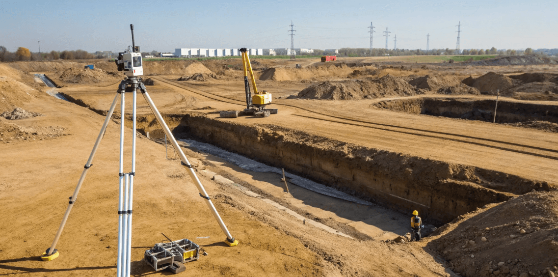
SUE is a specialized practice that involves much more than just finding pipes. A complete SUE investigation includes locating, identifying, and mapping the horizontal and vertical positions of underground utilities. This covers everything from water and sewer lines to gas, electric, and fiber optic cables. The goal is to create a detailed, 3D map of the subsurface environment. This information is then used to analyze potential conflicts with proposed designs, allowing engineers to make informed decisions early in the planning phase. These services are essential for any project involving excavation, from road construction and building development to utility infrastructure upgrades.
An Engineering-Based Approach to Locating
What truly sets SUE apart is that it’s a full engineering process, not just a single technology or service. It’s a holistic approach that starts with researching existing utility records and ends with a comprehensive map integrated into your project plans. The process involves coordinating with utility owners, planning for potential utility relocations, and assessing the condition of existing lines. By combining historical data with advanced field techniques, SUE provides a complete picture. This engineering-based method ensures that the information you receive is not just raw data but actionable intelligence that supports critical design and construction decisions.
How SUE Mitigates Project Risk
The primary goal of SUE is to reduce the significant risks tied to unknown or inaccurately mapped underground utilities. By providing precise data, SUE helps you avoid expensive project redesigns and prevent construction delays caused by unexpected conflicts. More importantly, it drastically reduces the chance of accidentally damaging a critical utility line during excavation. A utility strike can lead to dangerous accidents, service outages, and serious legal and financial consequences. Investing in professional subsurface utility mapping upfront is one of the most effective ways to protect your budget, your timeline, and your team’s safety.
What Are the SUE Quality Levels?
Subsurface Utility Engineering (SUE) isn’t a one-size-fits-all service. Instead, it uses a standardized system to classify the quality and accuracy of utility data. These are known as SUE Quality Levels, and they give you a clear framework for understanding the reliability of the information you’re working with. Think of them as building blocks—each level provides a higher degree of accuracy than the one before it, allowing you to request the precise level of detail your project requires.
This system, outlined in the ASCE 38 standard, ranges from Quality Level D (the most basic) to Quality Level A (the most precise). Understanding these levels helps you make informed decisions, manage risk, and invest your resources where they matter most. By specifying the right quality level, you can avoid both the danger of insufficient data and the unnecessary cost of over-collecting it. It’s all about matching the investigation to the risk.
Quality Level D: Starting with Existing Records
Quality Level D (QL-D) is the starting point for any subsurface investigation. This level involves gathering and reviewing existing utility records. We’re talking about as-built drawings, utility company maps, and even anecdotal information from site personnel. It’s essentially a paper-based study that compiles what is already known—or what is thought to be known—about the utilities on a site.
While QL-D is a necessary first step for project planning and route selection, it’s also the least reliable. Records can be outdated, inaccurate, or incomplete. This level provides a general idea of which utilities might be present, but it offers no verification of their actual location. It’s best used for preliminary assessments, not for design or excavation.
Quality Level C: Surveying from the Surface
Quality Level C (QL-C) takes the information from QL-D and adds a layer of visual confirmation. At this stage, a survey crew visits the site to locate and map visible, above-ground utility features. This includes manholes, valve boxes, utility poles, and fire hydrants. The locations of these features are then surveyed and correlated with the existing records from the QL-D investigation.
This process helps reconcile the paper records with what’s actually visible in the field, providing a more refined picture. However, QL-C still relies on inference. It doesn’t verify the horizontal or vertical position of the utility lines running between the visible structures. It’s a valuable step for projects in less congested areas but still carries significant risk for design and construction.
Quality Level B: Designating Utilities with Geophysical Methods
Quality Level B (QL-B) is where we move from reviewing records to actively searching for utilities. This is the first level that involves applying advanced geophysical techniques to detect and trace underground lines. Using tools like Ground Penetrating Radar (GPR) and Electromagnetic (EM) locators, technicians can determine the horizontal position of buried utilities. This process is often called "designating."
This is a major leap in accuracy. QL-B helps correct flawed records and can identify utilities that were never documented. The designated utilities are marked on the ground and then surveyed to create a comprehensive map. For most projects, QL-B provides the data needed to make critical design decisions and route new infrastructure to avoid conflicts.
Quality Level A: Exposing Utilities for Visual Confirmation
Quality Level A (QL-A) provides the highest degree of accuracy possible. This level involves physically exposing a utility to confirm its exact horizontal and vertical position. This is typically done using non-destructive methods like vacuum excavation, also known as "potholing" or "daylighting." By creating a small test hole, crews can visually inspect the utility.
This direct exposure allows us to collect precise data, including the utility’s depth, size, material, and condition. QL-A is the only way to be certain about a utility’s location. It’s essential for final design in areas where new construction will cross or run parallel to existing critical infrastructure, as it eliminates the risk of conflicts and costly strikes.
Matching the Quality Level to Your Project Needs
The goal of SUE isn’t to achieve Quality Level A across your entire site—that would be inefficient and expensive. The real value comes from strategically applying the right quality level to the right areas. By matching the quality level to your project needs, you can manage risk intelligently and prevent costly utility relocations or damages.
For example, you might use QL-B across the entire project footprint to create a comprehensive utility map for general design. Then, you would upgrade to QL-A at specific high-risk points, like where a proposed foundation will be installed near a major gas line. This targeted approach gives you the certainty you need for construction while keeping your project on budget and on schedule.
The Technology That Powers SUE
Subsurface Utility Engineering isn’t about a single magic wand; it’s a discipline that relies on a suite of advanced technologies working together. Think of it as a toolkit where each tool has a specific job. The right combination of methods allows skilled technicians to build a comprehensive picture of the underground environment, moving from educated guesses to verifiable facts. An experienced SUE provider knows which technology to apply based on the site conditions, the type of utilities expected, and your project’s specific goals.
This strategic approach ensures that the data collected is not only accurate but also directly useful for your design and construction teams. From sending radar waves into the ground to carefully exposing a pipe with vacuum excavation, each step is designed to reduce uncertainty and give you a clear path forward. The process combines sophisticated field instruments with powerful software to turn raw data into actionable intelligence. At SiteTwin, our crews use a combination of these methods to deliver fast, field-ready data that protects your projects from costly surprises.
Ground Penetrating Radar (GPR)
Ground Penetrating Radar, or GPR, is one of the most versatile tools in the SUE toolkit. It works by sending a tiny pulse of energy into the ground and recording the echoes that bounce back from buried objects. This allows technicians to detect both metallic and non-metallic utilities, like PVC water lines, fiber optic conduits, and concrete storm drains that other methods might miss. From GPR scanning to GPS-accurate maps, this technology is fundamental to creating a detailed view of subsurface infrastructure. It’s especially valuable on complex sites with a mix of old and new utilities where records are incomplete or non-existent.
Electromagnetic (EM) Locating
Electromagnetic (EM) locating is the go-to method for tracing conductive utilities. This technology works by detecting the electromagnetic fields that radiate from metallic pipes and cables. A transmitter energizes the target line with a specific frequency, and a receiver is used to trace its path and estimate its depth. While it’s ideal for locating power lines, communication cables, and metal water pipes, one of the biggest challenges in the industry is finding non-metallic lines. EM locators can still be effective in these cases if the utility was installed with a tracer wire, which can be energized just like a metal pipe. This makes EM a critical part of any comprehensive utility locating effort.
Vacuum Excavation
When you need absolute certainty about a utility’s location, vacuum excavation is the answer. This method, often called "soft digging" or "potholing," uses pressurized air or water to loosen the soil around a utility, while a powerful vacuum removes the debris. It’s a non-destructive way to physically expose a pipe or cable without the risk of damage that comes with a backhoe or shovel. This process is essential for achieving SUE Quality Level A, as it allows for direct visual confirmation of a utility’s exact horizontal and vertical position, size, material, and condition. It’s the final step in verifying the data collected by geophysical methods.
GPS and GIS Data Integration
Finding utilities is only half the job; accurately mapping them is what makes the data truly valuable. After a utility is located in the field, its position is captured using high-accuracy GPS equipment. This data provides precise geographic coordinates that can be integrated into digital maps. The information is then processed and layered into a Geographic Information System (GIS) or CAD file, creating a detailed and reliable utility map. This deliverable allows your engineers to design with confidence, overlaying the utility data onto project plans to identify potential conflicts early. Our GPS and GIS mapping services ensure your team has the clear, actionable data they need.
Turning Raw Data into Clear Maps
The final step in the SUE process is transforming all the collected field data into a clear, easy-to-understand deliverable. Raw signals from GPR and EM locators, along with GPS coordinates from exposed utilities, are synthesized into a single, comprehensive map. This isn't just a collection of points and lines; it's a fully interpreted record of the subsurface. For Quality Level A data, the map will show the utility's precise location, depth, size, and material type. This final report eliminates ambiguity, providing your engineers and project managers with a reliable foundation for making critical design and construction decisions, ultimately preventing conflicts and keeping your project on track.
How to Add SUE to Your Project Plan
Bringing Subsurface Utility Engineering into your project isn't just another box to check—it's a strategic move that protects your timeline, budget, and crew. Integrating SUE early in the planning phase gives you a clear picture of what’s underground before you even think about breaking ground. This proactive approach helps you sidestep the costly surprises and delays that come from hitting an unknown utility line. Instead of reacting to problems, you can design around them from the start.
The process is more straightforward than you might think. It begins with a thorough assessment of your site and a review of existing records. From there, a skilled field crew uses advanced technology to locate and map every utility with precision. This data isn't just a collection of points on a map; it's actionable intelligence. Your engineering team can use it to identify potential conflicts, adjust designs, and ensure the final plan is both safe and efficient. By making SUE a standard part of your workflow, you shift from guesswork to certainty, ensuring a smoother project from start to finish.
Starting with a Site Assessment
The first step in any SUE project is a comprehensive site assessment. This initial phase involves gathering and reviewing all available records about the utilities in your project area, which corresponds to Quality Level D. This includes as-built drawings, utility company maps, and previous survey data. While these records provide a good starting point, they are often outdated or incomplete. A professional SUE provider uses this information to build a preliminary understanding of the site and identify potential areas of concern before any equipment even arrives. This groundwork is essential for planning an efficient and effective field investigation.
The Field Investigation Process
Once the initial assessment is complete, the field investigation begins. This is where technicians use advanced geophysical methods to detect and designate underground utilities, bringing the data up to Quality Level B. Using tools like Ground Penetrating Radar (GPR) and Electromagnetic (EM) locators, crews can pinpoint the horizontal location of pipes and cables without digging. For critical areas requiring the highest level of accuracy (Quality Level A), technicians use non-destructive vacuum excavation to safely expose a utility, allowing for precise measurement of its horizontal and vertical position. This hands-on process provides the verified data needed for confident design and excavation.
Analyzing and Resolving Utility Conflicts
With accurate field data in hand, the next step is to analyze it for potential conflicts. This is where SUE truly shows its value. Your SUE provider will overlay the newly mapped utility locations onto your proposed design plans. This process immediately highlights any areas where a planned foundation, trench, or boring might clash with an existing gas line, water main, or fiber optic cable. Identifying these conflicts early allows your design team to make adjustments before construction begins, preventing expensive utility strikes, redesigns, and project delays. It’s a critical step that helps you manage the risks associated with underground infrastructure.
Integrating SUE Data into Your Design
The final deliverable from a SUE investigation is a detailed, accurate map of the subsurface environment. This isn't just a simple sketch; it's a professional CAD file or GIS layer that integrates directly into your project's design software. Engineers can use this precise subsurface utility mapping to route new infrastructure, place structures, and plan excavations with confidence. Having reliable data on existing utilities allows for more efficient and cost-effective designs, eliminating the need for large buffer zones or last-minute changes in the field. This seamless integration ensures that everyone from the project manager to the excavator operator is working with the same accurate information.
Meeting Industry and Regulatory Standards
A professional SUE process is guided by established industry standards, primarily the ASCE 38, "Standard Guideline for the Collection and Depiction of Existing Subsurface Utility Data." This standard defines the four quality levels (D, C, B, and A) and ensures that the data you receive is reliable, consistent, and clearly communicated. Adhering to these guidelines helps project owners and engineers understand the accuracy of the utility information they are working with. Choosing a provider that follows these standards ensures you receive defensible data that meets regulatory requirements and protects you from liability, making your entire project safer and more secure.
The ROI of Subsurface Utility Engineering
Investing in Subsurface Utility Engineering isn't just another line item on your project budget—it's a strategic move that pays for itself many times over. Think of it as insurance against the most common and costly risks in excavation and construction. When you have a clear picture of what’s underground, you can avoid the budget-breaking surprises that derail projects. From preventing dangerous utility strikes to eliminating redesigns, SUE delivers a tangible return by saving you time, money, and headaches. It's the difference between moving forward with confidence and hoping for the best.
The core value of SUE lies in its ability to transform unknowns into certainties. Instead of guessing where a critical fiber line or water main is located, you get precise data that informs every decision, from initial design to the moment the first shovel hits the ground. This proactive approach is about more than just finding pipes; it’s about managing risk effectively. By investing a small fraction of your project budget upfront, you protect your entire investment from unforeseen delays, costly repairs, and the legal liabilities that come with accidental utility damage. The numbers don't lie—the savings generated by SUE far outweigh its initial cost.
How SUE Prevents Costly Damage
A single utility strike can bring your entire project to a halt. The immediate costs are obvious: emergency repairs, crew downtime, and potential fines. But the ripple effects are often worse, leading to project delays and damaged client relationships. Comprehensive utility locating services remove the guesswork from excavation. Knowing exactly where utilities are located helps prevent accidents, injuries, and property damage. By creating an accurate subsurface map before you dig, you can plan your work with confidence, ensuring the safety of your crew and the integrity of the surrounding infrastructure. It’s the most effective way to avoid a five-figure mistake.
Keeping Your Project on Schedule
Unexpected utility conflicts are a primary cause of construction delays. Discovering an undocumented sewer line or a mislocated gas main after work has already begun forces expensive and time-consuming redesigns. SUE helps you get ahead of these issues. According to the Federal Highway Administration, accurate utility data allows designers to plan around existing infrastructure from the very beginning. This eliminates the need for last-minute changes and avoids the high cost of relocating utilities that could have been left untouched. By identifying conflicts during the design phase, you can keep your project on track and on budget, ensuring a smooth workflow from start to finish.
Protecting Critical Infrastructure
Your project doesn't exist in a vacuum. Hitting a major fiber optic cable, water main, or electrical line can cause widespread service outages that affect homes and businesses for miles around. This not only damages your company's reputation but can also lead to significant liability claims. SUE is an essential engineering practice that helps you understand and reduce the risks associated with unknown or poorly mapped utilities. By investing in detailed subsurface utility mapping, you demonstrate a commitment to protecting the critical infrastructure that communities rely on every day. It’s a responsible approach that safeguards both your project and the public.
Calculating the Long-Term Value
The financial case for SUE is clear and well-documented. It’s not just about avoiding costs; it’s about generating real savings. A landmark study conducted for the Federal Highway Administration found that for every $1.00 spent on SUE, an average of $4.62 was saved in avoided costs. These savings come from preventing utility relocations, eliminating unexpected conflicts, and reducing claims from utility strikes. When you factor in the costs of project delays, redesigns, and repairs, the return on investment becomes even more compelling. This data proves that SUE isn't an expense—it's one of the smartest financial decisions you can make for your project.
How to Choose the Right SUE Provider
Finding the right Subsurface Utility Engineering (SUE) provider is one of the most critical decisions you'll make for your project's success. The quality of the data you receive directly impacts your design, budget, and schedule. A great SUE partner does more than just find utilities; they provide the clarity and confidence you need to break ground safely. When you’re vetting potential providers, you’re looking for a true partner—a team that functions as an extension of your own.
The right provider combines technical skill with clear communication, giving you field-ready data you can trust. But not all SUE firms operate at the same level. Some rely on outdated equipment, while others lack the field experience to interpret complex findings. Taking the time to evaluate a provider on a few key criteria will save you from costly surprises down the road. Look for a team with a proven track record, a commitment to using modern technology, and a transparent process that keeps you informed every step of the way. This due diligence ensures your project is built on a solid foundation of accurate, reliable subsurface data.
Technical Expertise and Experience
When you’re dealing with buried infrastructure, there’s no substitute for experience. A team with years in the field has likely encountered every challenge imaginable, from congested urban corridors to sites with incomplete or nonexistent records. Their expertise allows them to interpret geophysical data accurately and solve problems on the fly. Before hiring a firm, ask about their experience with projects similar to yours. A provider with a strong track record will be able to handle the unique complexities of your site, ensuring a more thorough and reliable investigation. This hands-on knowledge is what separates a basic utility locator from a true subsurface mapping expert.
Up-to-Date Equipment and Technology
The SUE industry is driven by technology, and the equipment a provider uses makes a huge difference in the quality of their results. One of the biggest challenges is locating non-metallic utilities like PVC pipes and fiber optic cables, which traditional methods can easily miss. A firm that invests in the latest technology, such as advanced Ground Penetrating Radar (GPR) and electromagnetic (EM) locators, is better equipped to deliver a complete picture of the subsurface. This commitment to modern tools enhances the accuracy and efficiency of the investigation, reducing the risk of unexpected strikes and costly project delays. Always ask what kind of equipment a provider will use on your site.
A Clear Quality Control Process
Great results don't happen by accident; they're the product of a rigorous quality control process. A reliable SUE provider should be able to clearly explain their workflow for ensuring data accuracy from the field to the final report. This includes procedures for cross-referencing different technologies, peer-reviewing field markings, and verifying data before it's integrated into your project plans. A strong quality assurance program is your best defense against inaccurate information. It demonstrates the provider’s commitment to delivering dependable results and helps mitigate risks, ensuring your project stays on track and your team stays safe.
Responsive Communication and Reporting
Technical skills are essential, but so is clear and consistent communication. The best SUE providers are responsive, accessible, and dedicated to keeping you informed. You should be able to get a project manager on the phone without jumping through hoops. They should provide regular updates and be ready to answer your questions clearly. Just as important is the final deliverable. The data should be presented in a clean, easy-to-understand format that your engineers and designers can immediately put to use. A provider who prioritizes effective communication and timely GIS mapping ensures all stakeholders are aligned throughout the project.
Professional Certifications and Training
How can you verify a provider’s expertise? Look at their credentials. Reputable SUE firms ensure their technicians have the necessary certifications and ongoing training to operate specialized equipment and adhere to industry standards. This includes qualifications for using GPR and EM locating equipment as well as a deep understanding of the ASCE 38-22 Standard Guideline for Investigating and Documenting Existing Utilities. Checking for these credentials confirms that the provider is committed to professionalism and is compliant with established best practices. It’s a straightforward way to confirm you’re working with a team that takes safety and accuracy seriously.
Frequently Asked Questions
How is SUE different from the free 811 service? Think of 811 as the first step for public safety. They mark the approximate location of public utility lines running up to your property. Subsurface Utility Engineering, or SUE, is a comprehensive engineering process that takes over where 811 stops. We focus on mapping all utilities within your actual project site, including private lines that 811 doesn’t cover. SUE provides a much higher level of detail, including the depth and type of utility, to give your design team the precise data they need to prevent conflicts.
Do I need to get the most detailed level, Quality Level A, for my entire project? Not at all, and that’s the real value of the SUE process. It would be inefficient and costly to expose every utility across your whole site. The smart approach is to use the quality levels strategically. We typically start with a broader investigation (Quality Level B) to map the general layout of utilities for design purposes. Then, we only use the most precise method, Quality Level A, at specific high-risk points where a proposed structure or excavation will come critically close to an existing line.
What happens if my site has plastic pipes or utilities without a tracer wire? This is a common challenge where traditional locating methods fall short. That’s why we use a combination of technologies, especially Ground Penetrating Radar (GPR). GPR can detect non-metallic lines like PVC, concrete, and fiber optic conduits that electromagnetic locators can’t find on their own. By using the right tool for the job, we can build a complete picture of your site, not just the easy-to-find metallic utilities.
When is the best time to bring a SUE provider onto my project? The earlier, the better. The greatest value comes from integrating SUE during the initial planning and design phase. When your engineers have accurate utility data from the very beginning, they can design around potential conflicts, avoiding expensive redesigns and utility relocations later on. Bringing us in early turns subsurface data into a powerful planning tool rather than an emergency fix during construction.
What does the final SUE report actually look like? You won’t just get a handful of spray-painted marks on the ground. Our final deliverable is a clean, professional map that integrates directly into your design software, like CAD or GIS. This map clearly shows the horizontal and vertical locations of the utilities we identified, along with details like their size and material type. It’s a clear, actionable document that gives your entire team the reliable data they need to move forward with confidence.