
EM Locating vs GPR Scanning: What Contractors Need to Know Before Excavation
Utility locating is not one tool doing one job.
On real jobsites, private utility locating often means using more than one method to build a clearer picture of what may be in the ground.
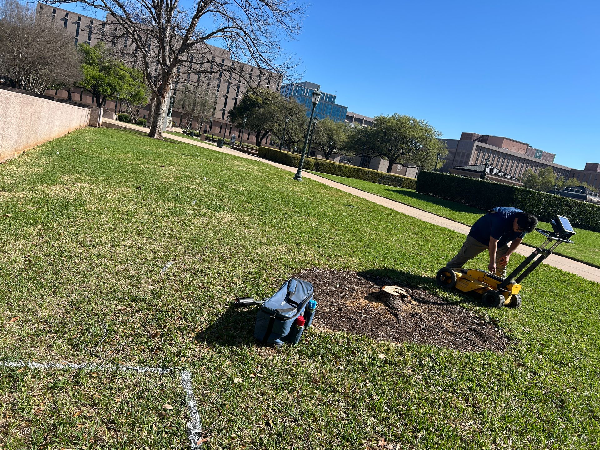
Private Utility Locating with SiteTwin
GPR Scanning with SiteTwin
Two of the most common methods are:
• EM locating
• GPR scanning
They do different things.
They see different targets.
They fail in different conditions.
And for trenching, boring, concrete cutting, saw cutting, coring, or utility tie-ins, knowing the difference matters before crews start opening ground.
What EM Locating Does
EM locating uses electromagnetic signal to locate conductive utilities.
That usually means utilities made of metal or utilities that have a tracer wire.
Common EM-locatable utilities include:
• Electric lines
• Telecom with tracer wire
• Gas lines with tracer wire
• Metallic water lines
• Metallic sanitary laterals
• Metallic storm components
• Site lighting circuits
• Irrigation wiring
• Communication duct banks with traceable conductors
EM locating works well when the locator can apply a signal directly to a utility, tracer wire, valve, riser, box, or exposed conductor.
It can also be used passively in some cases.
But passive locating is not a substitute for controlled utility investigation.
Passive signal can be crowded, distorted, or misleading in congested areas.
EM Locating Limitation Statement
EM locating is limited when utilities are non-conductive, broken, poorly bonded, missing tracer wire, abandoned, too deep, congested with other conductive lines, or affected by signal bleed onto nearby utilities.
That is why EM marks should be treated as approximate alignment, not guaranteed clearance.
What GPR Scanning Does
GPR scanning uses radar signal to identify subsurface changes.
Instead of tracing current or a conductive path, GPR looks for reflections from objects, voids, disturbed soil, reinforcing steel, conduits, pipes, and other buried features.
On exterior sites, GPR may be used during utility investigations for:
• Non-metallic utilities
• PVC lines
• Unknown pipes
• Abandoned utilities
• Utility trenches
• Irrigation crossings
• Storm laterals
• Shallow duct banks
• Utilities without tracer wire
• Areas where EM signal is unavailable
Inside structures, GPR is also used for concrete scanning before coring, saw cutting, anchoring, or demolition.
Concrete Scanning with SiteTwin
Common concrete targets include:
• Rebar
• Post-tension cables
• Conduits
• Embedded utilities
• Slab thickness changes
• Pan deck conditions
• Beams and structural features
GPR Limitation Statement
GPR scanning is limited by soil type, moisture, clay content, reinforcement congestion, surface conditions, depth, target size, and signal contrast.
GPR does not find everything, and depth readings should be treated as estimated depth unless confirmed by exposure.
The Simple Difference
EM locating follows a conductive signal.
GPR scanning reads subsurface reflections.
That is the field-level difference.
EM locating is usually strongest when:
• The utility is conductive
• A good access point exists
• Signal can be applied directly
• The site is not overloaded with signal bleed
• The locator can confirm direction changes and utility behavior
GPR scanning is usually strongest when:
• The utility may be non-metallic
• There is no tracer wire
• The site has abandoned or undocumented lines
• The work area needs broader subsurface investigation
• Concrete needs to be scanned before cutting or drilling
Why Contractors Often Need Both
Most active jobsites are not clean.
The drawings may be old.
The tenant build-out may have added utilities.
The parking lot may have lighting, irrigation, storm, telecom, and abandoned runs all crossing the same trench.
That is where EM locating and GPR scanning work together.
EM may trace the conductive power feed.
GPR may show a second unknown crossing nearby.
EM may follow a gas tracer wire.
GPR may identify a shallow abandoned utility running across the bore path.
Neither method should be treated as absolute.
Together, they give the excavation team better information for planning, potholing, boring, trench routing, and conflict coordination.
Texas 811 Clarification
Texas 811 is for notifying participating public utility owners before excavation.
It does not replace private utility locating on private property, inside facilities, behind meters, across parking lots, within industrial sites, on campuses, or in areas with owner-installed utilities.
Contractors should still coordinate private utility investigation where private, undocumented, abandoned, or facility-owned lines may exist.
Where EM Locating Performs Well
EM locating is usually the first method used when the crew needs to trace a known utility.
Good EM locating conditions may include:
• Accessible valve boxes
• Electric panels
• Transformer feeds
• Telecom pedestals
• Gas risers
• Water meters
• Traceable utility markers
• Known utility routes
• Clean signal separation
For trenching support, EM can provide fast alignment information when the utility is conductive and accessible.
For directional boring support, EM can help identify crossings along the proposed bore path.
For utility tie-ins, EM can assist with following known feeds back to source points or conflict areas.
Field Example 1: Parking Lot Utility Congestion
A contractor is preparing to trench across a retail parking lot in Houston.
The as-built shows power and water, but the pavement also has:
• Parking lot lighting
• Irrigation
• Telecom crossings
• Abandoned conduit
• Storm drain laterals
EM locating traces the site lighting circuit from accessible poles.
But several irrigation and telecom crossings do not produce reliable EM signal.
GPR scanning is used across the trench path to look for additional shallow conflicts.
The result is not a guarantee.
It gives the superintendent better information for potholing locations, trench layout, and crew sequencing.
Where GPR Scanning Performs Well
GPR is useful when the target may not carry signal.
That includes many private utilities.
Common examples:
• PVC water lines
• PVC irrigation lines
• Unknown storm laterals
• Abandoned utilities
• Non-metallic conduits
• Empty sleeves
• Shallow utility trenches
• Concrete-encased utilities
• Embedded slab conduits
GPR is also useful when the site history is messy.
That includes:
• Redevelopment sites
• Industrial expansions
• Tenant improvement construction
• Old retail centers
• Schools and campuses
• Warehouses
• Hospitals
• Manufacturing facilities
• Utility yards
• Parking lots with multiple remodels
GPR can identify features that do not respond to EM.
But interpretation still depends on site conditions, operator experience, surface access, grid coverage, and verification.
Where GPR Struggles
GPR performance can drop in:
• Wet clay
• Highly conductive soils
• Reinforced concrete with heavy rebar
• Areas with rough surface conditions
• Deep utilities
• Congested utility corridors
• Areas with poor target contrast
• Sites with standing water or saturated base
In concrete, GPR can also be complicated by:
• Dense rebar mats
• Post-tension cable layouts
• Pan deck
• Multiple slab pours
• Wire mesh
• Embedded conduits stacked over reinforcement
This is why concrete scanning should be coordinated with the cutting plan, core locations, slab access, and structural concerns.
Field Example 2: Core Drilling in a Tenant Improvement Space
A mechanical contractor needs to core several holes through a slab in Dallas.
The drawings show general plumbing locations, but the space has been remodeled twice.
The slab may include:
• Rebar
• Electrical conduits
• Post-tension cables
• Old floor box conduits
• Abandoned tenant utilities
GPR scanning is performed before coring.
The scan identifies reinforcement patterns and several linear anomalies near the proposed cores.
The contractor adjusts layout and uses field verification before drilling.
The scan does not certify the slab as clear.
It provides marked information so the cutting crew can make better decisions before work starts.
EM vs GPR for Directional Boring
Directional boring brings a different problem.
The crew is not just opening one trench.
They are crossing utilities underground, often with limited visual exposure.
For boring work, EM locating may be used to trace known conductive utilities along the bore path.
GPR scanning may be used to investigate additional crossings, especially where private utilities or undocumented lines may be present.
Common boring conflict zones include:
• Driveway crossings
• Parking lot islands
• Irrigation mains
• Telecom laterals
• Gas services
• Electric secondaries
• Storm laterals
• Private water lines
• Facility-owned utilities
For boring, the goal is not just paint on the ground.
The goal is conflict management.
That means:
• Mark approximate alignments
• Identify areas needing potholes
• Confirm known crossings
• Investigate undocumented crossings
• Coordinate bore depth with field conditions
• Maintain communication between locator, superintendent, and bore crew
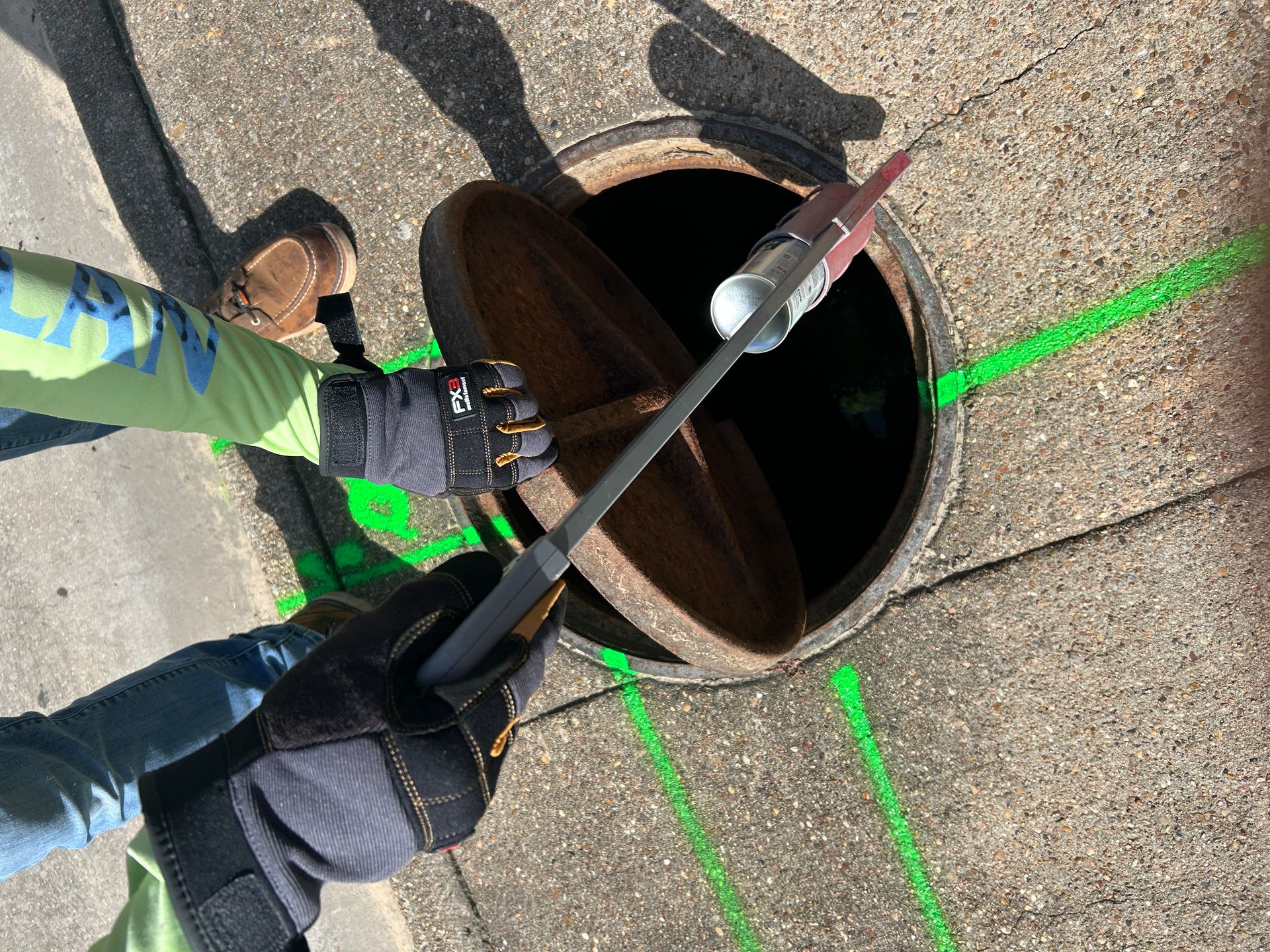
Potholing Verification Statement
Paint, flags, GPR markings, EM marks, and estimated depth should be verified by potholing or other approved exposure methods when exact utility location is needed for excavation, boring, tie-ins, or close-clearance work.
Potholing confirmation is what turns investigation marks into exposed field information.
Need Utility Verification Before Trenching or Boring?
Submit the locate scope, drawings, work limits, and proposed excavation path so SiteTwin can coordinate EM locating, GPR scanning, and verification support.
Schedule a Locate
EM vs GPR for Utility Depth
Depth is where contractors need to be careful.
Both EM and GPR can provide estimated depth in certain conditions.
But estimated depth is not the same as exposed depth.
EM depth can be affected by:
• Signal bleed
• Congested utilities
• Poor grounding
• Utility material
• Nearby conductors
• Induced signal
• Incorrect transmitter setup
GPR depth can be affected by:
• Soil velocity assumptions
• Moisture
• Material changes
• Target shape
• Signal quality
• Reinforcement
• Surface conditions
For excavation planning, estimated depth can support planning.
For close work, potholing confirmation should control.
Which Method Is Better?
Neither method is automatically better.
The right method depends on the target, site conditions, utility material, access, and excavation scope.
Use EM locating when:
• A conductive utility can be traced
• Access points are available
• The utility has tracer wire
• Known utilities need alignment marking
• The crew needs production support over a defined path
Use GPR scanning when:
• Utilities may be non-metallic
• Records are incomplete
• Abandoned utilities may exist
• Concrete needs to be scanned
• No traceable access point exists
• Unknown crossings are likely
Use both when:
• The site is congested
• Utility ownership is mixed
• Boring is planned
• Trenching crosses multiple corridors
• The area has old as-builts
• Private utilities are likely
• Excavation exposure is limited
Service Areas for Utility Investigation
SiteTwin supports utility investigation work across major Texas construction markets, including:
Houston Services
Dallas Services
Austin Services
San Antonio Services
Fort Worth Services
Project conditions vary by city and site type.
A downtown utility corridor in Austin may have telecom congestion and old service feeds.
A warehouse expansion in Fort Worth may have private fire lines, electrical duct banks, and storm infrastructure.
A San Antonio redevelopment site may include abandoned utilities from previous tenants or phased construction.
The locating plan should match the site, not a generic checklist.
How Contractors Should Scope the Work
Before scheduling EM locating or GPR scanning, gather the information that affects production:
• Site address
• Excavation limits
• Proposed trench path
• Bore path and pits
• Core locations
• Saw cut layout
• Available drawings
• Utility maps
• Known utility owners
• Access limitations
• Gate codes or escort requirements
• Work hours
• Areas needing potholing
• Areas with known conflicts
A better scope gives the field crew a better starting point.
It also helps separate public utility notification from private utility investigation.
What to Expect in the Field
A utility investigation may include:
• Site walkdown
• Review of available plans
• EM locating of traceable utilities
• GPR scanning of target work areas
• Marking approximate alignments
• Identifying unknown anomalies
• Estimated depth where conditions allow
• Field notes or deliverables depending on scope
• Recommendations for potholing or exposure
The work should be coordinated with the excavation plan.
Locating without knowing the trench, bore, tie-in, or cut area can leave gaps.
The locator needs to know where crews will actually work.
Common Mistakes to Avoid
Do not assume 811 marks cover private utilities.
Do not assume GPR will identify every buried line.
Do not assume EM signal stayed on the intended utility.
Do not treat estimated depth as exposed depth.
Do not bore through congested crossings without verification.
Do not core concrete based only on old drawings.
Do not ignore abandoned utilities.
Do not skip potholing when clearance is tight.
The field goal is simple:
Find likely conflicts.
Mark approximate alignments.
Verify where the work gets close.
Keep excavation planning tied to real site conditions.
FAQ
Is EM locating the same as GPR scanning?
No.
EM locating traces conductive utilities using electromagnetic signal.
GPR scanning uses radar reflections to identify subsurface features.
They are different methods and are often used together during private utility investigations.
Can GPR find utilities that EM locating cannot?
Sometimes.
GPR may identify non-metallic utilities, abandoned lines, PVC pipes, empty sleeves, and other features that do not carry EM signal.
But GPR performance depends on soil, moisture, depth, surface conditions, and target contrast.
Can EM locating find PVC utilities?
Only if the PVC utility has a traceable wire, conductive component, or another way to apply or detect signal.
PVC without tracer wire is a common reason contractors add GPR scanning to the investigation.
Does Texas 811 locate private utilities?
Texas 811 notifies participating public utility owners.
It does not replace private utility locating for owner-installed, private, abandoned, facility-owned, or undocumented utilities on private property.
Contractors working behind meters, inside plants, across parking lots, or on redevelopment sites often need private utility investigation.
Can either method give exact utility depth?
Depth should be treated as estimated unless the utility is exposed and confirmed.
EM and GPR depth readings can be affected by field conditions.
For close-clearance excavation, boring, or tie-ins, potholing confirmation should be used.
Which method is better before directional boring?
For directional boring, both methods may be needed.
EM locating can trace known conductive utilities.
GPR scanning can investigate possible non-metallic or undocumented crossings.
Potholing should confirm critical crossings before the bore proceeds.
Is GPR used for concrete scanning?
Yes.
GPR is commonly used for concrete scanning before coring, saw cutting, anchoring, or slab demolition.
It can help identify rebar, post-tension cables, conduits, and embedded features, but findings should still be coordinated with the cutting plan and field verification.