
Austin GPR Scanning Services
Construction projects in Austin often take place on sites with incomplete utility records, ongoing development, and changing underground conditions. Whether the project involves trenching, directional boring, utility installation, drainage improvements, or commercial site work, contractors need a better understanding of what may be underground before excavation begins.
That is where GPR scanning can help. Ground penetrating radar is commonly used as part of underground utility investigations to help identify potential subsurface targets before digging starts.
SiteTwin | GPR Scanning Services
For contractors, developers, engineers, and property owners, the goal is simple: reduce uncertainty before excavation and avoid costly utility conflicts.
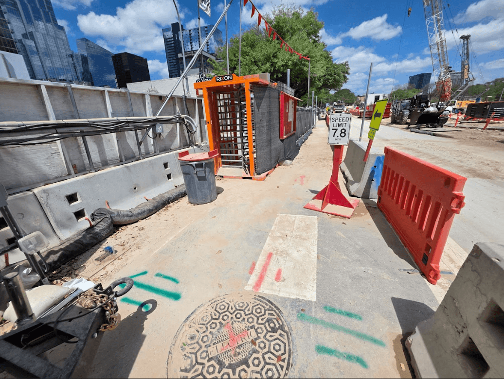
What Is GPR Scanning?
Ground penetrating radar (GPR) is a non-destructive technology used to investigate subsurface conditions. The equipment sends radar signals into the ground and analyzes reflections from buried objects and changes in underground materials.
Depending on site conditions, GPR may help identify:
- Utility corridors
- Buried utilities
- Abandoned infrastructure
- Trench lines
- Unknown underground targets
- Subsurface anomalies
GPR is frequently used when utility records are incomplete or when contractors need additional information before excavation.
Why Austin Contractors Use GPR
Austin continues to experience rapid commercial, residential, and infrastructure growth. As properties are developed and redeveloped, underground utility conditions often become more complex.
Contractors commonly use GPR when:
- Utility records are incomplete
- Private utilities may be present
- Existing utility markings do not match field conditions
- Tracer wire is missing
- Non-conductive utilities are suspected
- Directional boring is planned
- Excavation crosses congested utility corridors
The purpose is not to replace excavation planning. It is to provide additional information before ground disturbance begins.
How GPR Supports Utility Investigations
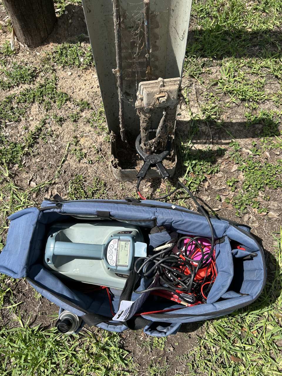
GPR is typically used alongside other utility locating methods. A utility investigation may include:
- Site records review
- Surface feature inspection
- Electromagnetic locating
- GPR scanning
- Utility markings
- Documentation and mapping
SiteTwin | GPR Scanning Services
Combining multiple investigation methods helps create a more complete picture of underground conditions. This approach is especially valuable on commercial developments, schools, multifamily projects, industrial facilities, and redevelopment sites throughout Austin.
Understanding GPR Limitations
GPR is a valuable investigation tool, but it has limitations. Detection can be affected by:
- Soil type
- Moisture conditions
- Clay content
- Utility depth
- Utility material
- Surface conditions
- Underground congestion
Because of these factors, GPR does not guarantee that every underground utility will be identified. A qualified investigation should include a discussion of both findings and limitations before excavation proceeds.
Planning excavation in Austin? SiteTwin performs private utility locating, GPR scanning, and underground utility investigations for contractors and property owners throughout Austin and Central Texas. Request a locate.
Why Potholing Is Still Important
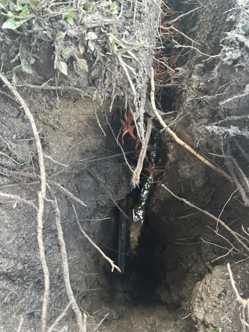
Even after utilities have been located and marked, physical verification may still be necessary. When excavation risk is high, potholing or daylighting should be used to verify utility depth, location, and type before mechanical excavation continues through a conflict area.
This is particularly important before:
- Directional boring
- Deep trenching
- Utility tie-ins
- Gas crossings
- Power crossings
- Fiber crossings
- Congested utility corridors
GPR helps identify potential conflicts. Potholing confirms what is actually underground. Both play an important role in excavation risk reduction.
Documentation and Deliverables
Depending on project requirements, SiteTwin may provide:
- Utility paint markings
- Site photos
- PDF utility maps
- KMZ exports
- GIS-compatible utility mapping
- Conflict notes
- Potholing recommendations
These deliverables help contractors, engineers, and project managers coordinate work using the same field information.
Austin Construction and Development Projects
Austin's continued growth has created demand for utility investigations across commercial, industrial, municipal, educational, and multifamily developments.
As properties expand and infrastructure evolves, underground conditions can become difficult to predict from records alone. GPR scanning helps contractors gather additional field information before excavation begins.
Austin GPR Scanning FAQ
What is GPR scanning used for?
GPR scanning is used to investigate underground conditions and identify potential buried utilities, utility corridors, and subsurface anomalies before excavation.
Can GPR find all underground utilities?
No. Soil conditions, utility depth, material type, moisture, and underground congestion can affect detection. GPR does not guarantee that every utility will be found.
When should GPR scanning be performed?
GPR is commonly used before excavation, trenching, directional boring, utility installation, drainage work, and site development projects.
Does Austin utility locating require potholing?
When excavation risk is high, potholing should be used to physically verify utility depth, location, and type before mechanical excavation continues.
Why use GPR with utility locating?
GPR can provide additional information about subsurface conditions, particularly when utility records are incomplete or utilities may not be traceable with traditional locating methods.
Investigate Before You Dig in Austin
Before excavation begins, make sure underground conditions have been properly investigated. GPR scanning can provide valuable information that helps Austin contractors reduce uncertainty and avoid costly utility conflicts.