
Records vs. Reality: Why As-Built Drawings Are Not Enough to Prevent Utility Strikes
As-built drawings are an important part of planning construction, engineering, and excavation work, but they should never be treated as a perfect representation of what is actually underground. A drawing may show where a utility was intended to be installed, where it was believed to have been installed, or where it was documented years ago. That does not always mean the utility is still in that exact location today.
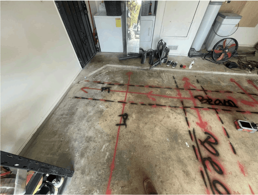
For engineers, surveyors, general contractors, and project owners, that distinction matters. Properties change over time. Utilities are repaired, rerouted, abandoned, replaced, and added during future expansions. Some of those changes are carefully documented. Others are not. By the time a new project begins, the records may only tell part of the story.
That is why field verification is so important. Existing drawings can help guide the investigation, but they should be viewed as a starting point rather than the final answer.
Why As-Built Drawings Do Not Always Match Field Conditions
In theory, an as-built drawing should reflect the final constructed condition of a site. In practice, the accuracy and level of detail can vary significantly depending on when the work was completed, who documented it, and how much the property has changed since then.
Utilities are often shifted during construction to avoid unexpected conflicts. A planned route may encounter an existing foundation, another utility, unsuitable soil, drainage infrastructure, or site access limitations. Crews may adjust the alignment in the field so work can continue, but that change does not always make it back into the final drawing with survey-level accuracy.
Older properties present another challenge. A commercial or industrial site may have gone through decades of repairs, tenant improvements, building additions, utility upgrades, and emergency work. A water line may have been rerouted after a failure. Electrical service may have been extended to a new building. Fiber may have been added later. Parking lot lighting, fire lines, irrigation, security systems, and private communications may all have been installed at different times by different contractors.
Even when documentation exists for each individual project, those records may be scattered across multiple owners, contractors, engineering firms, municipalities, facility departments, and utility providers. The result is often a set of records that is useful, but incomplete.
The Difference Between Design Intent and Existing Conditions
One of the biggest risks in utility planning is assuming that a line shown on a drawing represents a verified underground location. Older drawings in particular may show approximate routes rather than precise horizontal or vertical positioning.
A utility may be drawn in a way that communicates general design intent without providing the positional accuracy needed for trenching, boring, foundation work, or other construction activities. That can become a serious problem when a future project relies on the drawing as though it were survey-grade information.
Private utilities are especially vulnerable to this issue. Commercial campuses, warehouses, manufacturing facilities, multifamily properties, and large developments often contain extensive networks of privately owned infrastructure. These may include electrical feeders, private water and sewer, fire lines, site lighting, irrigation, gas, fiber, security systems, and underground conduit.
Many of these lines may never appear in public utility records, and older private utility documentation can be limited or missing altogether.
Abandoned infrastructure adds another layer of uncertainty. A line may be taken out of service without being physically removed. Years later, the site may contain both active and abandoned infrastructure in the same corridor. A historical drawing may show the line but not its current status, while a newer drawing may omit it entirely because it was considered abandoned.
For excavation and design purposes, both situations still matter.
Why Utility Conflicts Become Expensive So Quickly
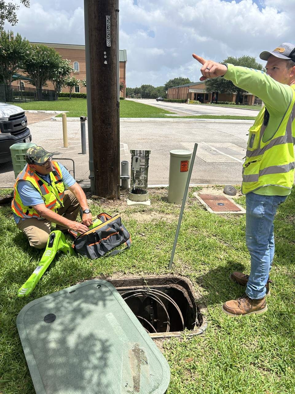
The cost of a utility problem is not limited to the repair itself. In many cases, a project starts losing money before any utility is even damaged.
An unexpected line discovered during excavation can stop production while the project team determines what it is, who owns it, whether it is active, and how the design should change. That can lead to additional locating, surveying, redesign, change orders, crew downtime, equipment downtime, schedule extensions, and utility coordination.
If an active line is damaged, those costs can escalate further. Gas, electrical, communications, water, and sewer strikes can create safety hazards, service outages, emergency-response costs, property damage, environmental concerns, and significant project delays.
For a general contractor, the most expensive part of a utility strike is often not the physical repair. It is the chain reaction that follows. A utility conflict can affect subcontractor sequencing, inspections, deliveries, traffic control, client schedules, and other work that depends on the affected area being completed.
That is why the best time to discover a utility conflict is during planning and design, not after excavation begins.
Records Still Matter, but They Should Be Verified
Existing utility records are still extremely valuable. Historical plans, as-builts, GIS information, previous surveys, utility-owner records, and facility knowledge can help identify what infrastructure is expected on the site and where additional investigation may be necessary.
The mistake is treating those records as confirmed conditions.
A better approach is to use the records to guide the field investigation. If plans indicate that electrical service crosses a proposed excavation area, that information helps the locating team understand what to look for. If the field results do not match the drawings, that discrepancy can be investigated before construction reaches the area.
This records-plus-field approach is one of the core ideas behind Subsurface Utility Engineering.
How Subsurface Utility Engineering Helps Close the Gap
Subsurface Utility Engineering, commonly referred to as SUE, provides a structured way to investigate and document existing underground utilities. Instead of treating every utility line on a drawing as equally reliable, SUE helps project teams understand how that information was obtained and how much confidence should be placed in it.
The ASCE/UESI/CI 38-22 standard provides a framework for evaluating and documenting utility information. For engineers, surveyors, and contractors, this is especially useful because it separates historical or record-based information from information that has been observed, located, or physically verified in the field.
That distinction matters during design. A utility shown from an old record should not carry the same level of confidence as a utility that has been geophysically located or physically exposed.
Understanding the SUE Quality Levels
SUE information is commonly organized using Quality Levels D, C, B, and A. These levels do not simply describe how “good” a drawing looks. They indicate the source of the utility information and the level of investigation behind it.
Quality Level D is based largely on existing records and historical information. This may include as-built drawings, utility maps, GIS data, previous surveys, construction plans, and institutional knowledge. It is useful for early planning, but it does not confirm the current underground position of the utility.
Quality Level C adds visible surface features to that information. Manholes, valves, utility poles, handholes, meters, hydrants, pedestals, and other observable features can be surveyed and compared against the existing records. This helps project teams identify inconsistencies and better understand how underground systems may connect.
Quality Level B involves geophysical investigation to designate the horizontal position of underground utilities. Technologies such as electromagnetic locating and ground penetrating radar are commonly used during this stage. This is where the project team begins moving from record-based assumptions toward current field conditions.
Quality Level A provides the highest level of positional information because the utility is physically exposed at a specific location. Methods such as vacuum excavation are often used to confirm exact depth, position, size, or material where that information is critical to design or construction.
For project teams, the value of these quality levels is that they communicate confidence. Two utility lines may appear identical on a CAD file, but one may have come from a 30-year-old drawing while the other was located and verified during the current project. Those two lines should not be treated the same.
How EM Locating and GPR Support Field Verification
No single locating technology can identify every underground utility. That is why effective utility investigations often rely on multiple methods.
Electromagnetic locating is commonly used to trace conductive utilities or tracer wires. It can be highly effective for electrical lines, metallic piping, communications, fiber with tracer wire, gas lines with tracer wire, and conductive conduit.
Ground penetrating radar, or GPR, provides another layer of subsurface information. It can be useful when investigating non-metallic utilities, unknown lines, abandoned infrastructure, utility trenches, buried structures, and other subsurface anomalies that may not be traceable using conventional electromagnetic equipment.
GPR should not be treated as an underground X-ray, however. Results can be affected by soil conditions, utility depth, target material, surface conditions, moisture, and other site factors. That is why the strongest utility investigations typically combine available records, field observations, EM locating, GPR, and physical verification when necessary.
Why Engineers and Surveyors Need to Know the Source of Utility Data
Engineering and survey files frequently combine information from several different sources. A single base map may contain surveyed features, utility-owner records, GIS information, previous plans, historic as-builts, and newly collected field data.
Once everything is placed on the same drawing, it can be difficult to tell which information has actually been verified and which information is still based on historical records.
That creates risk during design. A proposed storm line, foundation, bore path, retaining wall, or utility relocation may appear conflict-free because the existing utility was plotted incorrectly or based on outdated information.
Understanding the source and quality of the utility data allows engineers and surveyors to make better decisions about where additional investigation is necessary before design is finalized.
SiteTwin works with engineers and surveyors to help bridge the gap between existing records and current field conditions through utility locating and mapping services.
Why General Contractors Need More Than Public Utility Marks
Public utility notification remains an essential part of excavation safety, but it does not replace a comprehensive investigation of private or undocumented infrastructure.
Large commercial sites frequently contain utility systems that are not owned by public utility companies. A warehouse complex may have private electrical lines running between buildings, lighting circuits throughout the parking area, fire protection lines, communications, security infrastructure, private water and sewer, and other underground systems.
Those utilities can create significant risk even when all required public utility notifications have been completed.
SiteTwin works with general contractors to identify subsurface conditions before those conditions become construction problems. For contractors, the goal is not simply to put paint on the ground. It is to reduce uncertainty before crews, equipment, and schedules are committed to the work.
Turning Field Data Into Useful Utility Mapping
Utility locating becomes far more valuable when the information is documented in a format that can be used throughout the project.
A field crew may successfully identify underground infrastructure, but if the only record is temporary paint on the surface, much of that information is eventually lost. Weather, construction activity, traffic, and time can quickly remove those markings.
SiteTwin provides utility as-built and mapping services that can help turn field findings into long-term project information. Depending on the scope, deliverables may include GPS/GIS utility mapping, PDF maps, KMZ files, CAD-compatible information, utility exhibits, and other forms of project documentation.
The goal is to make field investigation useful beyond the day the locating work was performed. Better documentation can support engineering, construction coordination, future maintenance, and future projects on the same property.
Better Utility Information Can Reduce Redesign and Delays
One of the biggest benefits of early utility investigation is that it gives the project team more options.
Consider a proposed storm drain that appears to have adequate clearance from an existing utility based on the available drawings. If excavation begins and the utility is discovered several feet away from the documented position, construction may have to stop while the team verifies the line, evaluates the conflict, redesigns the improvement, obtains approvals, and reschedules the work.
If that same discrepancy is discovered during design, the engineer can evaluate alternatives before construction crews ever mobilize.
That difference can significantly reduce disruption.
The earlier the project team understands the actual subsurface conditions, the easier it is to adjust designs, coordinate relocations, change bore paths, move foundations, or investigate critical crossings.
When Existing Utility Records Should Be Verified
Some projects carry more subsurface uncertainty than others. Additional investigation becomes especially important when existing drawings are old, multiple records conflict, or the property has been repeatedly renovated or expanded.
Verification should also be considered when private utilities are expected, abandoned infrastructure may be present, directional drilling is planned, soil borings are required, or proposed improvements will be constructed near existing utilities.
Projects involving operating facilities deserve particular attention. Hospitals, industrial plants, manufacturing sites, campuses, data facilities, commercial properties, and other active sites may have very little tolerance for unexpected outages or utility damage.
In those environments, better subsurface information can help the team make more informed decisions before the work reaches the field.
From Historical Records to Better Future As-Builts
The larger goal of modern utility mapping is not simply to identify what is underground for one project. It is to improve the quality of utility information that future teams will inherit.
ASCE 38-22 provides a framework for investigating and documenting existing utilities, while ASCE 75-22 addresses the recording and exchange of utility infrastructure data. Together, these standards reflect a broader shift toward better management of subsurface information.
Instead of repeatedly copying uncertain utility lines from one drawing to another, project teams can improve the record through field investigation, mapping, and documentation.
That creates better information for future engineers, surveyors, contractors, owners, and facility teams.
As-Builts Are the Starting Point, Not the Final Answer
As-built drawings, utility maps, and historical records all play an important role in understanding a site. The problem comes when those documents are treated as though they eliminate uncertainty.
They do not.
Every record reflects information collected at a specific point in time, using a specific method, for a specific purpose. The underground environment may have changed significantly since that information was created.
For engineers, surveyors, general contractors, and project owners, the better question is not simply, “Where does the drawing show the utility?”
It is, “How confident are we that this is where the utility actually exists today?”
That is the difference between relying on records and actively managing subsurface risk.
Verify Existing Utilities Before Design or Construction
SiteTwin helps engineers, surveyors, general contractors, developers, and facility teams investigate and document underground infrastructure before it becomes a field conflict.
Our services include private utility locating, electromagnetic locating, ground penetrating radar, GPS/GIS utility mapping, utility as-built documentation, and SUE-related utility investigation.
Whether your team is validating existing plans, preparing a design survey, investigating a proposed bore path, planning excavation, or creating better utility records for future projects, SiteTwin can help turn subsurface uncertainty into usable project information.
Request Utility Locating or Mapping Services
Learn more about our Utility As-Built & Mapping Services, services for General Contractors, and services for Engineers & Surveyors.