
Using GPR for Underground Utility Locating
When contractors plan excavation, one of the biggest challenges is understanding what may be underground before digging starts. Drawings may be incomplete. Utility records may be outdated. Private utilities may have been added years after original construction. In many cases, the underground conditions do not match the plans.
That is why many utility investigations include ground penetrating radar (GPR). GPR helps contractors investigate subsurface conditions before trenching, directional boring, drilling, grading, or excavation begins.
While GPR is not a replacement for other locating methods, it can provide valuable information when underground conditions are uncertain.
What Is GPR?
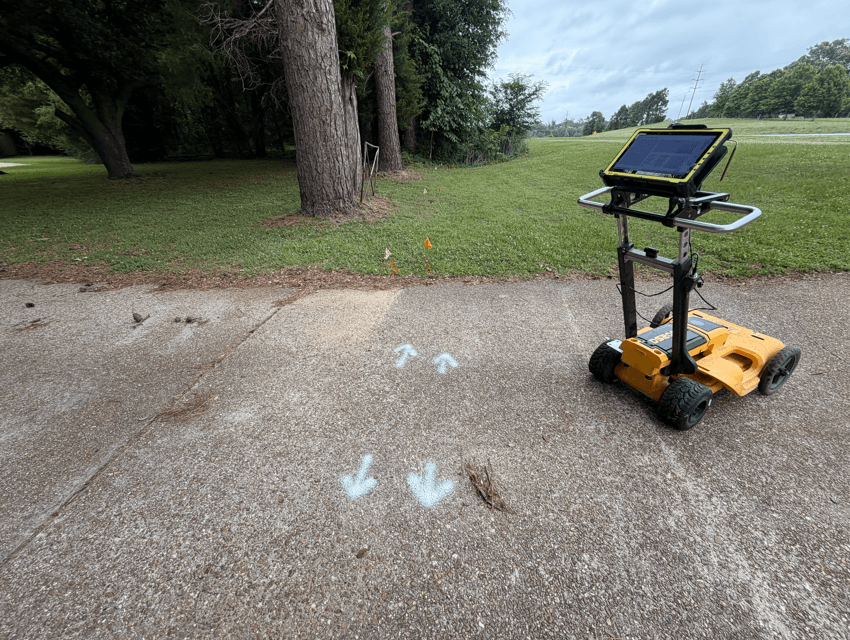
Ground penetrating radar is a non-destructive technology that uses radar signals to investigate subsurface conditions. As the equipment moves across the ground, radar signals are transmitted into the surface and reflected back from buried objects or changes in material. These reflections help technicians identify potential underground targets within the scan area.
Depending on site conditions, GPR may help identify:
- Buried utility corridors
- Non-conductive utilities
- Abandoned utilities
- Trench lines
- Unknown underground targets
- Voids and subsurface anomalies
GPR provides another layer of information during a utility investigation.
Why Contractors Use GPR
Many underground utilities cannot be easily traced using traditional locating methods alone. Plastic water lines, PVC conduit, abandoned infrastructure, and utilities without tracer wire can be difficult to investigate using electromagnetic locating.
GPR can help when:
- Utility records are incomplete
- Tracer wire is missing
- Utilities are non-conductive
- The site contains unknown infrastructure
- Private utilities are suspected
- Ecavation crosses congested utility corridors
- Utility markings do not match field conditions
For contractors, the goal is simple: reduce uncertainty before excavation begins.
How GPR Works With Utility Locating
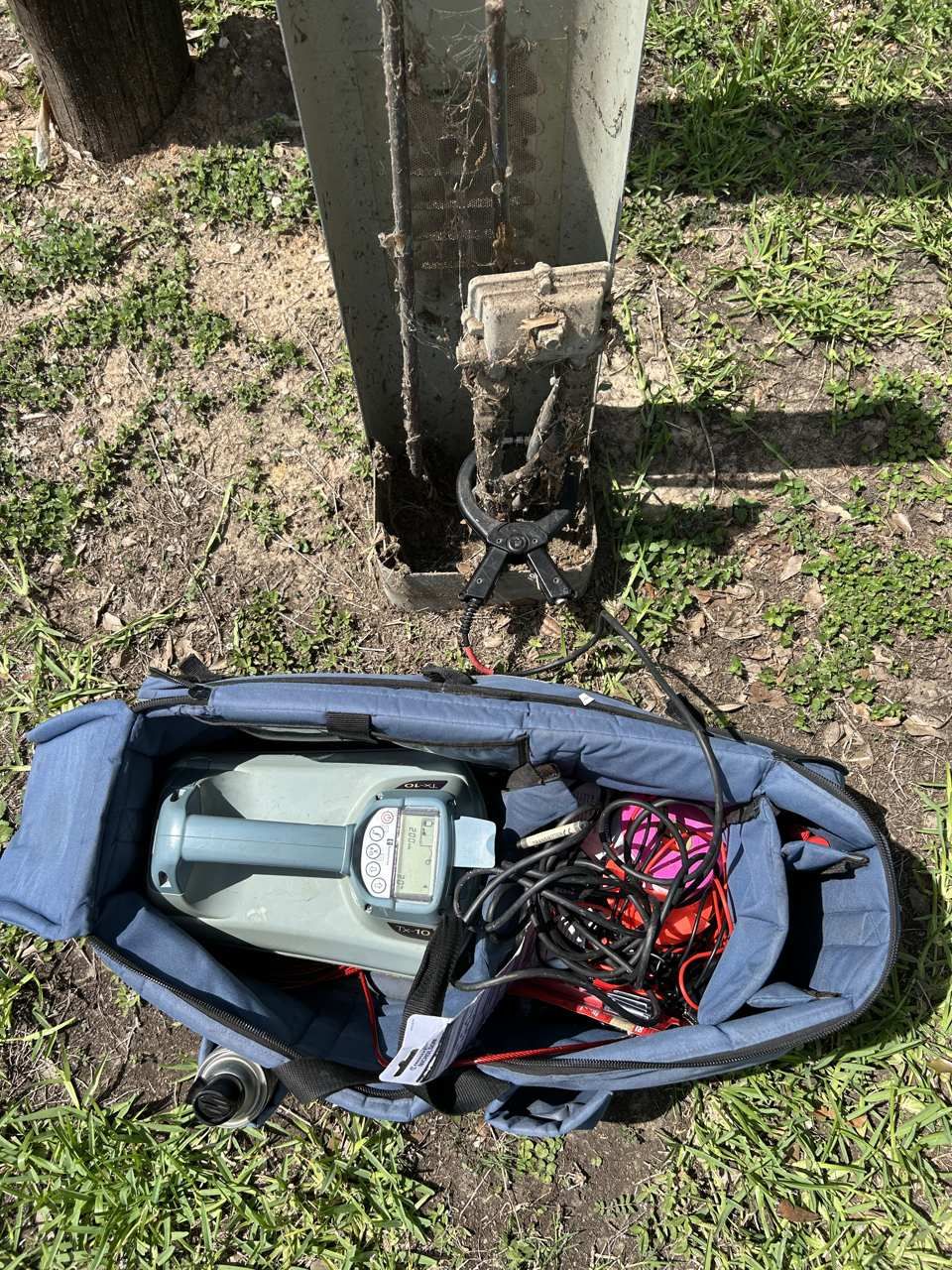
GPR is often used alongside other locating methods rather than as a standalone service.
A utility investigation may include:
- Records review
- Site inspection
- Electromagnetic locating
- GPR scanning
- Utility marking
- Documentation
- Potholing recommendations
SiteTwin | GPR Scanning Services
By combining multiple methods, technicians can compare findings and develop a clearer picture of underground conditions. This approach is especially useful on commercial and industrial properties where utilities may have been installed, modified, or abandoned over time.
GPR Limitations
GPR is a valuable investigation tool, but it is important to understand its limitations. GPR does not guarantee that every underground utility will be found. Detection can be affected by:
- Soil type
- Clay content
- Moisture conditions
- Utility depth
- Surface conditions
- Utility material
- Site congestion
- Debris and underground interference
Some environments produce clearer radar responses than others. Because of these limitations, GPR should be viewed as one part of a broader utility investigation rather than a complete solution by itself. A qualified technician should communicate scan limitations and areas of uncertainty before excavation begins.
Planning excavation or utility work? SiteTwin performs private utility locating, GPR scanning, and underground utility investigations for contractors and property owners across Texas.
Why Potholing Still Matters
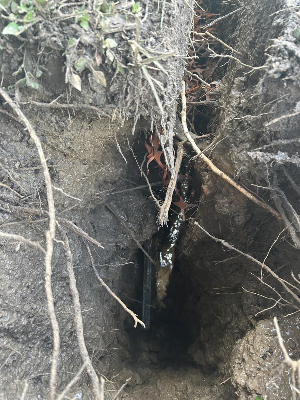
Even after utilities have been located and marked, physical verification may still be required. When excavation risk is high, potholing or daylighting should be used to verify utility depth, location, and type before mechanical excavation continues through a conflict area.
This is especially important before:
- Directional boring
- Deep trenching
- Utility tie-ins
- Gas line crossings
- Power crossings
- Fiber crossings
- Congested utility corridors
- GPR helps identify potential conflicts.
GPR helps identify potential conflicts. Potholing confirms what is actually underground. Using both methods together can help contractors make better excavation decisions.
Common Applications for GPR Utility Locating
GPR is commonly used before:
- Excavation
- Trenching
- Directional boring
- Utility installation
- Dainage work
- Parking lot reconstruction
- Site development
- Utility repairs
- Commercial construction
- Industrial projects
It is particularly useful on properties where utility records are limited or where private infrastructure may not be fully documented.

Texas Utility Locating Projects
Across Texas, GPR is frequently used on commercial, industrial, educational, healthcare, and municipal projects.
SiteTwin | Check Out Our Service Locations
In many cases, properties have been expanded, repaired, or redeveloped over time, creating underground conditions that may not match available records. GPR helps contractors gather additional information before excavation begins. You can also view our service locations.
GPR Utility Locating FAQ
What is GPR utility locating?
GPR utility locating uses ground penetrating radar to investigate underground conditions and identify potential buried utilities or subsurface targets.
Can GPR find all underground utilities?
No. Soil conditions, moisture, utility depth, material, and site congestion can affect detection. GPR does not guarantee that every utility will be found.
Is GPR better than EM locating?
They serve different purposes. EM locating is often used to trace conductive utilities, while GPR can help investigate non-conductive utilities and unknown underground targets.
When should GPR be used?
GPR is commonly used before excavation, trenching, directional boring, utility installation, and other projects where underground conditions are uncertain.
Do I still need potholing after GPR?
In high-risk areas, yes. Potholing physically verifies utility depth, location, and type before excavation continues.
Investigate the Ground Before You Dig
GPR can provide valuable information about underground conditions before excavation begins, but it works best as part of a complete utility investigation. Before trenching, boring, or digging, make sure the work area has been properly investigated and marked.