
Utility Locating Before Geotechnical Drilling: A Boring-Location Checklist
A proposed soil boring looks simple on a site plan: a point, an identification number, and a target depth. In the field, that point might fall beside a private electrical feed, over an undocumented water service, or in a parking space the locator could not access.
Before the drill rig arrives, the project team needs to establish what was investigated at each boring location, what remains uncertain, and what happens if a point moves.
Utility locating before geotechnical drilling should combine the applicable 811 process, a review of site-owned infrastructure, and a field investigation matched to the proposed work. A small-diameter boring still requires attention to buried utilities. Geoprobe, a drilling-equipment manufacturer, specifically instructs operators to establish the location of underground utilities before pushing tools at a job site.
1. Send the boring plan, not just the property address
A street address helps a locator find the property. It does not identify the investigation area.
Send a marked plan showing each proposed boring, with a consistent identifier such as B-01 or B-02. Include the plan revision and identify any alternate locations the geotechnical team has already approved.
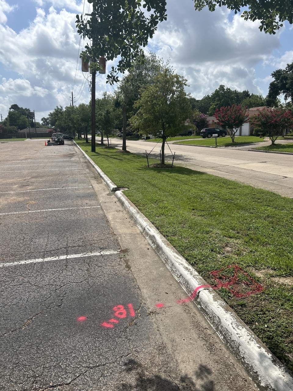
The scope should also explain:
- The number of borings or probe locations.
- The drilling or testing method.
- Planned penetration depths and diameters, where known.
- Whether work starts through soil, asphalt, or concrete.
- Whether equipment installation introduces other ground penetrations.
- Access restrictions, working hours, and the proposed drilling date.
Discuss the area to investigate around each point before fieldwork. The scope needs enough coverage to interpret nearby utility paths and accommodate agreed alternatives. There is no single scan radius that makes every boring location acceptable.
2. Check 811 coverage and private utility ownership separately
An 811 ticket and a private utility investigation answer different parts of the same question.
Texas811 notifies participating facility operators about proposed excavation. Its guidance explains that some utilities, including privately owned facilities, may not be marked through that process. A commercial site can contain owner-maintained lighting circuits, irrigation, fire lines, or services between buildings that need separate attention.
Ask the property representative for available utility drawings and for someone familiar with the site’s maintenance history. Identify who owns and operates each known system rather than assuming the property boundary or meter resolves every ownership question.
Follow the applicable notification, response, and excavation requirements. Hiring a private locator does not replace the 811 process. Texas811’s current excavator guide is a useful starting point for planning that work.
3. Make the investigation area accessible
A locator cannot evaluate ground covered by a parked truck or scan through a stack of materials.
Before mobilization, arrange access to the boring locations and the surrounding investigation areas. That may mean reserving parking spaces, moving stored materials, unlocking gates, or coordinating an escort.
Also identify accessible utility features that could help the investigation, such as valve boxes, cleanouts, and designated tracing points. Arrange any necessary access through the owner or an authorized person. Do not assume the locating crew can open restricted electrical equipment or enter a confined space.
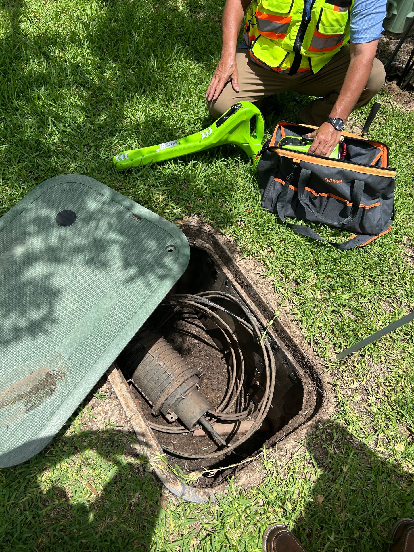
If part of an area remains inaccessible, have that boundary documented. A report should distinguish between an investigated area with no detected target and an area that was never investigated.
4. Match the locating methods to the conditions
Electromagnetic locating and ground penetrating radar provide different information.
EM locating can help trace conductive utilities or tracing wires when a usable signal is available. Signal distortion and nearby infrastructure can affect interpretation and depth estimates. Radiodetection warns that locator depth readings must not be used to set mechanical digging depths.
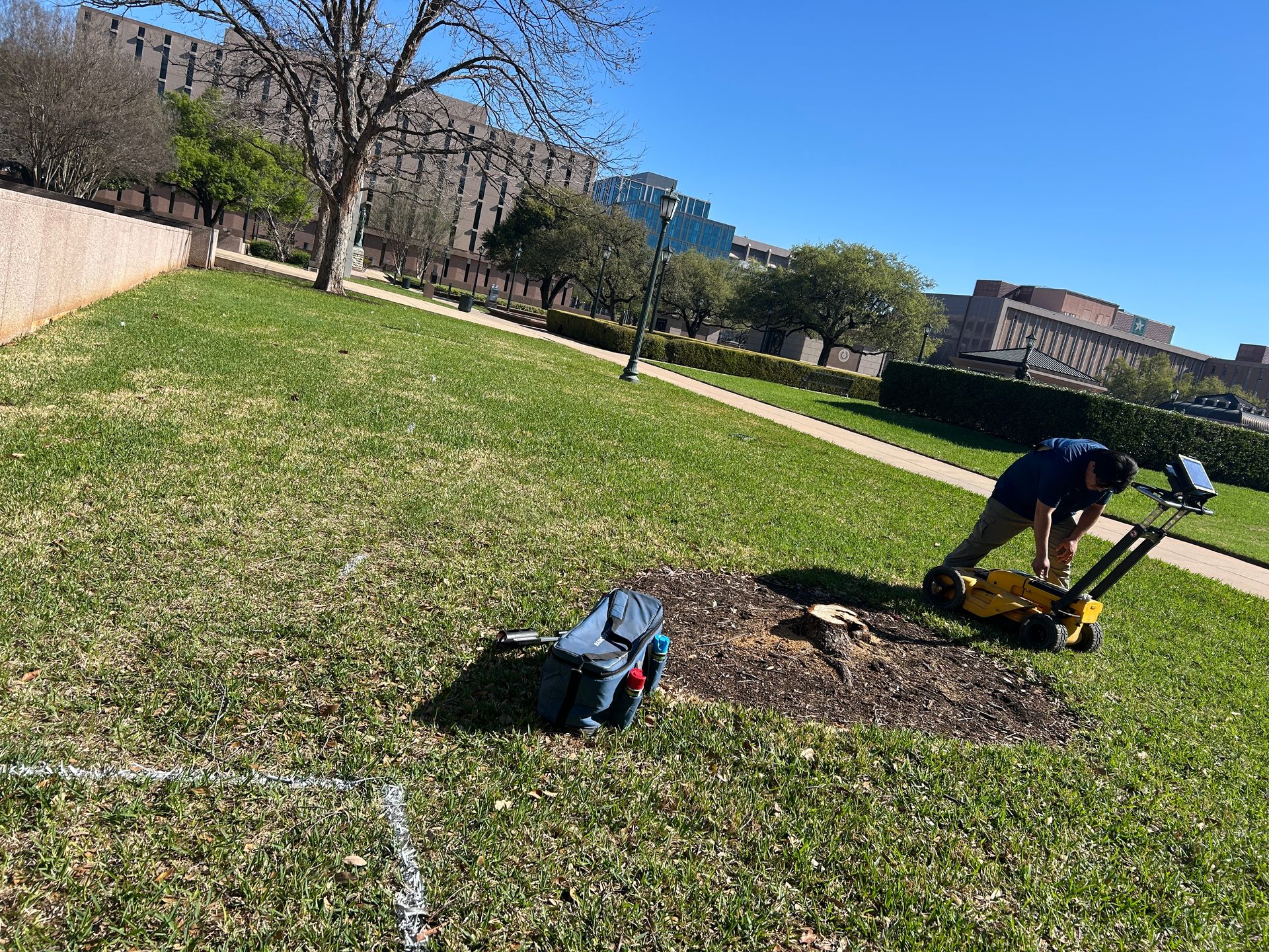
GPR can identify subsurface reflections that warrant investigation, including some targets that cannot be traced electromagnetically. Its performance depends on the ground and the target. Conductive materials, including some clay soils, can substantially limit radar penetration.
Ask the locator to explain the limitations encountered at the actual site. A blank scan does not establish that the entire planned bore depth is free of utilities.
Where a boring starts through concrete, discuss concrete scanning separately. Investigation of embedded reinforcement or conduits and investigation of utilities beneath the slab may require different coverage and interpretation.
5. Resolve conflicts before the drilling crew sets up
A detected line near a proposed boring needs a documented decision.
Depending on the findings, the project team may need to:
- Have the geotechnical professional approve another location.
- Investigate an unexplained signal or discrepancy.
- Coordinate with the facility owner.
- Arrange physical exposure to verify a utility at a critical location.
- Defer the boring until the uncertainty is resolved.
Where OSHA’s excavation requirements apply, the standard requires the estimated location of expected underground installations to be determined before excavation. It also requires their exact location to be established by safe and acceptable means when excavation approaches them.
The appropriate verification method depends on the utility, site conditions, and applicable requirements. A locator’s estimated depth should not become the drilling crew’s assumed clearance.
6. Treat a moved boring as a scope change
Consider a proposed boring marked B-04. The locator investigates it on Monday. When the rig arrives, a delivery truck blocks the point, so someone proposes moving the boring several feet.
Before proceeding, confirm that the new point is within the documented investigation coverage and that the findings support work there. If it falls outside that coverage, or the existing information does not resolve the risk, investigate the revised location first.
The geotechnical professional also needs to approve relocation for the sampling program. Moving away from a utility does not automatically make a new point suitable for the engineering investigation.
Record the revised location and retain the connection to the original boring identifier. Avoid leaving the locator, driller, and project manager with three different versions of B-04.
7. Request a boring-by-boring handoff
A site-wide map is useful, but the drilling crew also needs information tied to its actual work points.
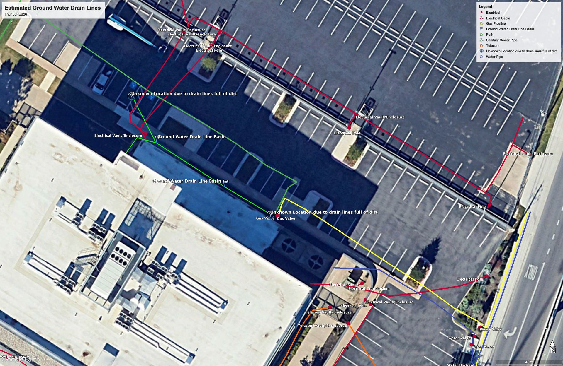
For each boring, ask the report to identify:
- The boring ID and plan revision used.
- The investigation date and coverage boundary.
- Locating methods used.
- Detected utilities and unresolved anomalies.
- Inaccessible areas and other limitations.
- Supporting field photographs.
- Any verification or further investigation still needed.
For example, “B-03: eastern portion inaccessible because of stored materials; further investigation needed before drilling” gives the project manager a specific issue to resolve.
Before drilling, reconcile the report with current field markings, ticket information, the latest boring plan, and any changes in site conditions. Do not let a general “clear” label obscure a limitation attached to an individual location.
Request utility locating for a Texas drilling project
SiteTwin provides private utility locating, GPR scanning, and GPS/GIS utility documentation for Texas construction and infrastructure projects.
To discuss a geotechnical drilling scope, send SiteTwin the project address and boring plan, along with the number of locations, planned methods and depths, surface conditions, access restrictions, and target field date.
Include approved alternate points if you have them. Identifying those alternatives before mobilization gives the team a chance to investigate them before a blocked or conflicted boring disrupts the drilling schedule.
Planning a horizontal bore under a road or utility corridor instead? See our guide to utility locating before directional boring.